
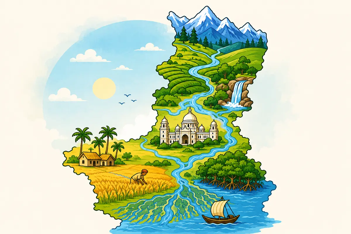
WBCS Mains West Bengal Geography Question – 2023
1. Which city is known as the ‘Silk City’ of West Bengal ?
(A) Asansol
(B) Durgapur
(C) Murshidabad
(D) Siliguri
Answer: (C) Murshidabad
Explanation: Murshidabad is known as the ‘Silk City’ of West Bengal, owing to its centuries-old tradition of silk production, dating back to the Mughal and Nawabi era when it served as the capital of Bengal. The district is particularly famous for producing high-quality mulberry silk and traditional woven fabrics like Baluchari sarees, supported by favorable conditions for sericulture and a skilled base of traditional weavers passed down through generations.
Asansol and Durgapur are primarily known as industrial towns associated with coal, steel, and heavy engineering industries in the western part of the state, while Siliguri is a major commercial and transit hub in North Bengal — none of these carry the historical or economic association with silk production that defines Murshidabad’s identity.
Silk Industry of West Bengal:
| District | Facts |
|---|---|
| Murshidabad | Known as “Silk City” of West Bengal; mulberry silk, Baluchari sarees; historic Nawabi-era hub |
| Malda | Also known for mulberry silk production |
| Bankura/Purulia | Known for Tussar (non-mulberry) silk |
| Asansol/Durgapur | Industrial towns (coal, steel, heavy engineering) |
| Siliguri | Commercial/transit hub of North Bengal |
2. The East Calcutta Wetlands have been declared as a
(A) Biosphere Reserve
(B) Reserve Forest
(C) Ramsar Site
(D) National Park
Answer: (C) Ramsar Site
Explanation: The East Calcutta Wetlands have been declared a Ramsar Site under the Ramsar Convention on Wetlands, an international treaty for the conservation and sustainable use of wetlands. This recognition acknowledges the wetlands’ ecological importance as a unique natural system that treats and recycles Kolkata’s sewage through a network of fish ponds (bheris), agricultural land, and garbage farms, making it one of the world’s largest wastewater-fed aquaculture systems.
East Kolkata Wetlands:
| Aspect | Details |
|---|---|
| Designation | Ramsar Site (Wetland of International Importance) |
| Year designated | 2002 |
| Function | Natural wastewater treatment via fish ponds (bheris) |
| Comparison | Sundarban Wetland is West Bengal’s other Ramsar Site (2019) |
3. What is the significance of the Farakka Barrage in West Bengal?
(A) Hydroelectric power generation
(B) Flood control
(C) Navigation and irrigation
(D) Drinking water supply
Answer: (C) Navigation and irrigation
Explanation: The primary significance of the Farakka Barrage lies in facilitating navigation and irrigation, specifically by diverting a portion of the Ganga’s water through a feeder canal into the Bhagirathi-Hooghly channel. This diversion was designed to address the declining navigability of the Hooghly River caused by reduced freshwater flow and increasing siltation, which was severely impacting Kolkata Port’s operations, while also supporting irrigation needs in the surrounding lower deltaic plains of West Bengal.
Farakka Barrage:
| Aspect | Details |
|---|---|
| Primary significance | Navigation (preserving Hooghly/Kolkata Port) and irrigation |
| Mechanism | Diverts Ganga water via feeder canal into Bhagirathi-Hooghly |
| Location | Murshidabad district, near India-Bangladesh border |
| Completion year | 1975 |
| Related treaty | India-Bangladesh Ganges Water Treaty, 1996 |
4. In which of the following states black soil is not found?
(A) Maharashtra
(B) Andhra Pradesh
(C) Gujarat
(D) West Bengal
Answer: (D) West Bengal
Explanation: Black soil (Regur soil), formed from the weathering of Deccan Trap basaltic rocks, is characteristically found in the Deccan Plateau region of India, covering states like Maharashtra, Andhra Pradesh, Gujarat, Madhya Pradesh, and parts of Karnataka and Telangana. West Bengal, being located in the eastern part of the country and predominantly covered by alluvial soil (in its deltaic plains) and lateritic soil (in its western plateau fringe districts), does not have significant black soil deposits, as it lies outside the volcanic basaltic terrain associated with black soil formation.
Black (Regur) Soil Distribution in India:
| State | Black Soil Present? |
|---|---|
| Maharashtra | Yes — core of Deccan Trap black soil belt |
| Andhra Pradesh | Yes — parts of the state |
| Gujarat | Yes — Saurashtra region |
| West Bengal | No — predominantly alluvial and lateritic soil |
| Other black soil states | Madhya Pradesh, Karnataka, Telangana |
5. Which district in West Bengal is known for its terracotta temples ?
(A) Bankura
(B) Malda
(C) Birbhum
(D) Jalpaiguri
Answer: (A) Bankura
Explanation: Bankura district in West Bengal is renowned for its terracotta temples, particularly those found in and around the town of Bishnupur, which was the historic capital of the Malla dynasty. These temples, built primarily during the 17th and 18th centuries, showcase intricate terracotta artwork depicting scenes from Hindu mythology, epics, and everyday life, making Bishnupur a significant center of Bengal’s terracotta temple architecture and a popular heritage tourism destination.
Malda, Birbhum, and Jalpaiguri are known for other cultural, agricultural, or geographic distinctions — Malda for mangoes and silk, Birbhum for its association with Rabindranath Tagore’s Santiniketan and Baul culture, and Jalpaiguri for its tea gardens and proximity to wildlife sanctuaries — but none of these districts carries the specific renown for terracotta temple architecture that defines Bankura, particularly its Bishnupur temples.
Terracotta Temples of West Bengal:
| District | Facts |
|---|---|
| Bankura | Famous for terracotta temples, especially in Bishnupur (Malla dynasty capital) |
| Bishnupur temples | Built 17th-18th century; intricate terracotta artwork depicting mythology |
| Birbhum | Known for Santiniketan (Tagore), Baul culture |
| Malda | Known for mangoes, mulberry silk |
| Jalpaiguri | Known for tea gardens, wildlife sanctuaries |
6. Kunur is a tributary of which river?
(A) Ajay river
(B) Kangsabati river
(C) Mayurakshi river
(D) Rupnarayan river
Answer: (A) Ajay river
Explanation: The Kunur River is a tributary of the Ajay River, flowing through the western plateau fringe districts of West Bengal, particularly through parts of Birbhum and Purba Bardhaman. This river system forms part of the broader network of rivers originating in or near the Chota Nagpur plateau region that eventually feed into the larger Bhagirathi-Hooghly river system.
Rivers of Western West Bengal (Tributary Relationships):
| River | Tributary Of | Region |
|---|---|---|
| Kunur | Ajay River | Birbhum, Purba Bardhaman |
| Ajay (Ajoy) | Joins Bhagirathi-Hooghly | Birbhum, Bardhaman |
| Kumari | Kangsabati (Kasai) | Purulia, Bankura |
| Barakar | Damodar | Border of Jharkhand-West Bengal |
7. Which Indian city is known as the headquarters of the Eastern Railway Zone ?
(A) Patna
(B) Kolkata
(C) Guwahati
(D) Bhubaneswar
Answer: (B) Kolkata
Explanation: Kolkata serves as the headquarters of the Eastern Railway Zone, one of the seventeen (now more) zones of Indian Railways. This zone was established to oversee railway operations across significant parts of eastern India, including regions of West Bengal, Bihar, and Jharkhand, with Kolkata’s historical and continued significance as a major railway hub in eastern India making it the natural choice for the zone’s administrative headquarters.
Patna, Guwahati, and Bhubaneswar are headquarters of other Indian Railway zones or divisions — Guwahati serves as headquarters for the Northeast Frontier Railway zone, while Bhubaneswar hosts the headquarters of the East Coast Railway zone — but the Eastern Railway zone’s headquarters is specifically located in Kolkata.
Indian Railway Zones (Eastern India):
| Zone | Headquarters | Coverage |
|---|---|---|
| Eastern Railway | Kolkata | Parts of West Bengal, Bihar, Jharkhand |
| South Eastern Railway | Kolkata (Garden Reach) | Parts of WB, Odisha, Chhattisgarh, Jharkhand |
| Northeast Frontier Railway | Guwahati | Northeast India, parts of North Bengal |
| East Coast Railway | Bhubaneswar | Odisha and adjoining areas |
8. The Tropic of Cancer passes through which of the following districts of West Bengal?
(A) Murshidabad
(B) Birbhum
(C) Nadia
(D) Malda
Answer: (C) Nadia
Explanation: The Tropic of Cancer (23.5°N latitude) passes through Nadia district in West Bengal, specifically near Krishnanagar, the district headquarters, which is commonly cited as the point where this significant latitude line crosses the state. This positioning places Nadia district within the broader belt of Indian states and districts that the Tropic of Cancer traverses as it crosses the subcontinent from Gujarat in the west to Mizoram in the east.
Tropic of Cancer in West Bengal:
| District | Relation to Tropic of Cancer |
|---|---|
| Nadia (Krishnanagar) | Standard reference point for Tropic of Cancer crossing in West Bengal |
| Total Indian states crossed | 8 (Gujarat, Rajasthan, MP, Chhattisgarh, Jharkhand, West Bengal, Tripura, Mizoram) |
9. Haldia Petrochemical LTD. (HPL) was established in which year?
(A) 1992
(B) 1984
(C) 1974
(D) 1988
Answer: (A) 1992
Explanation: Haldia Petrochemicals Limited (HPL) was established in 1992, as a major petrochemical manufacturing unit located in Haldia, Purba Medinipur district, West Bengal. HPL was set up as a joint venture involving the West Bengal government and private sector participation, and it has since grown into one of India’s significant integrated petrochemical complexes, producing polymers and other petrochemical products that serve as critical raw materials for various downstream industries.
Haldia Petrochemicals and Industrial Complex:
| Facility | Year Established | Key Facts |
|---|---|---|
| Haldia Petrochemicals Limited (HPL) | 1992 | Joint venture; West Bengal government + private sector; polymer production |
| Haldia Oil Refinery (IOC) | 1975 | Operated by Indian Oil Corporation |
| Location | Haldia, Purba Medinipur district | Major industrial and port town on Hooghly River |
10. According to the Census of India, 2011, in West Bengal, the highest sex ratio was found in the district of
(A) Hooghly
(B) Darjeeling
(C) Birbhum
(D) Murshidabad
Answer: (B) Darjeeling
Explanation: According to the 2011 Census, Darjeeling district recorded the highest sex ratio among the districts of West Bengal. This relatively favorable sex ratio in Darjeeling is often attributed to the district’s distinct socio-cultural composition, including its significant hill population with different social practices compared to some of the plains districts of the state, along with demographic patterns influenced by its hill economy (tea plantations, tourism).
Sex Ratio in West Bengal Districts (Census 2011):
| District | Sex Ratio Trend |
|---|---|
| Darjeeling | Highest sex ratio among West Bengal districts |
| Hooghly | Below Darjeeling’s figure |
| Birbhum | Below Darjeeling’s figure |
| Murshidabad | Below Darjeeling’s figure |
| West Bengal state average (2011) | 950 |
11. The “ Jaldapara National Park ” is famous for _____ animal.
(A) Asiatic lion
(B) Indian rhinoceros
(C) Snow leopard
(D) Bengal tiger
Answer: (B) Indian rhinoceros
Explanation: Jaldapara National Park, located across Jalpaiguri and Alipurduar districts of West Bengal, is famous for its population of the Indian one-horned rhinoceros (Rhinoceros unicornis). It holds the distinction of having the second-largest population of this rhinoceros species in India after Kaziranga National Park in Assam, making it a critical conservation site for this vulnerable species within the grassland and riverine forest ecosystem along the Torsa River.
Asiatic lion, snow leopard, and Bengal tiger are found in other parts of India — the Asiatic lion is exclusively found in Gir National Park (Gujarat), the snow leopard inhabits high-altitude Himalayan regions (not typically Jaldapara’s terrain), and while Bengal tigers are found in parts of India including some Sundarbans habitat, Jaldapara’s specific and defining wildlife identity is centered on the Indian rhinoceros.
Jaldapara National Park:
| Aspect | Details |
|---|---|
| Famous for | Indian one-horned rhinoceros |
| Districts | Jalpaiguri and Alipurduar |
| Rank in rhino population (India) | 2nd largest, after Kaziranga National Park (Assam) |
| Habitat type | Grassland and riverine forest along Torsa River |
| Other notable species | Elephants, various deer species, birds |
12. Serampore , Belgharia and Sodepur are known for
(A) Paper Industry
(B) Textile Industry
(C) Sugar Industry
(D) Iron and Steel Industry
Answer: (A) Paper Industry
Explanation: Serampore, Belgharia, and Sodepur, all located along the Hooghly riverbank belt in West Bengal (in Hooghly and North 24 Parganas districts), are known for their paper industry. This industrial corridor along the Hooghly River developed historically due to easy access to water for paper manufacturing processes, along with proximity to Kolkata’s markets and transportation networks, making it one of the traditional paper production hubs of eastern India.
Textile industry, sugar industry, and iron and steel industry are associated with other industrial regions of West Bengal and India more broadly — the Hooghly riverbank belt encompassing Serampore, Belgharia, and Sodepur, however, is specifically and historically tied to paper manufacturing.
Industrial Towns Along the Hooghly River Belt:
| Town | Industry |
|---|---|
| Serampore | Paper industry; also historically significant as a Danish colonial settlement |
| Belgharia | Paper industry |
| Sodepur | Paper industry |
| Titagarh | Also part of the paper industry belt along Hooghly |
| Hooghly riverbank industrial belt | Historically developed due to water access, proximity to Kolkata |
13. Which is the oldest mountain railway in India that is a UNSECO World Heritage Site?
(A) Konkan Railway
(B) Darjeeling Himalayan Railway
(C) Nilgiri Mountain Railway
(D) Kalka-Shimla Railway
Answer: (B) Darjeeling Himalayan Railway
Explanation: The Darjeeling Himalayan Railway (DHR), popularly known as the “Toy Train,” is the oldest mountain railway in India to receive UNESCO World Heritage Site status, inscribed in 1999 under the “Mountain Railways of India” designation. Built in 1881 during British colonial rule, this narrow-gauge railway connects New Jalpaiguri to Darjeeling, traversing steep Himalayan terrain through a series of loops and zigzag reverses, and it remains an iconic engineering feat and heritage attraction in North Bengal.
UNESCO-Listed Mountain Railways of India:
| Railway | Year Built | UNESCO Inscription |
|---|---|---|
| Darjeeling Himalayan Railway | 1881 | 1999 — oldest and first inscribed |
| Nilgiri Mountain Railway | 1908 | 2005 (extension of “Mountain Railways of India”) |
| Kalka-Shimla Railway | 1898-1903 | 2008 (extension of “Mountain Railways of India”) |
| Konkan Railway | 1998 | Not a UNESCO World Heritage Site |
14. Tilpara irrigation canal is situated in
(A) Birbhum
(B) Purulia
(C) Malda
(D) None of the above
Answer: (A) Birbhum
Explanation: The Tilpara irrigation canal system, originating from the Tilpara Barrage, is situated in Birbhum district, West Bengal. The barrage itself is built across the Mayurakshi River near Suri (the district headquarters of Birbhum), and the associated canal network distributes water for irrigation purposes across the surrounding agricultural lands, forming a key component of the broader Mayurakshi Reservoir Project.
Purulia and Malda are other districts of West Bengal, but the Tilpara irrigation canal is specifically located in Birbhum district, given its direct connection to the Tilpara Barrage on the Mayurakshi River near Suri.
Tilpara Barrage and Canal System:
| Aspect | Details |
|---|---|
| Location | Birbhum district, near Suri |
| River | Mayurakshi |
| Part of | Mayurakshi Reservoir Project (also includes Massanjore Dam upstream) |
| Purpose | Irrigation for surrounding agricultural areas |
15. Which is the highest peak in West Bengal ?
(A) Sandakphu
(B) Singalila
(C) Tiger Hill
(D) Darjeeling peak
Answer: (A) Sandakphu
Explanation: Sandakphu is the highest peak in West Bengal, standing at approximately 3,636 meters, located within the Singalila range in Darjeeling district. It is renowned for offering spectacular panoramic views of four of the world’s five highest peaks — Everest, Kangchenjunga, Lhotse, and Makalu — on clear days, making it a popular trekking destination within Singalila National Park.
Singalila refers to the mountain range itself (not a peak), Tiger Hill is a well-known viewpoint near Darjeeling town famous for sunrise views over Kangchenjunga (but with a much lower elevation than Sandakphu), and “Darjeeling peak” is not a standard, recognized geographical name — Darjeeling itself is a hill town, not a peak.
Highest Peak of West Bengal:
| Aspect | Details |
|---|---|
| Peak | Sandakphu |
| Elevation | ~3,636 meters |
| Mountain range | Singalila range |
| District | Darjeeling |
| Notable feature | Views of Everest, Kangchenjunga, Lhotse, Makalu |
| Tiger Hill | Popular sunrise viewpoint near Darjeeling, lower elevation |
16. Which district in West Bengal is known for the production of the ‘ Gobindobhog ‘ variety of rice, which has a GI tag?
(A) Purba Medinipur
(B) Bankura
(C) Bardhhaman
(D) Murshidabad
Answer: (C) Bardhhaman
Explanation: Gobindobhog rice, a distinctive short-grain, aromatic rice variety known for its unique fragrance and flavor, is primarily cultivated in Bardhaman (Burdwan) district of West Bengal and has received a Geographical Indication (GI) tag recognizing its unique regional characteristics tied to this area’s specific soil and climatic conditions. This aromatic rice variety is traditionally used in Bengali cuisine, particularly for preparing dishes like khichuri and various sweets (payesh), and holds significant cultural and culinary importance in the region.
GI-Tagged Rice Varieties of West Bengal:
| Rice Variety | District | Facts |
|---|---|---|
| Gobindobhog | Bardhaman (Burdwan) | Aromatic short-grain rice; GI-tagged; used in khichuri, payesh |
| Tulaipanji | Uttar Dinajpur | Another aromatic GI-tagged rice variety of West Bengal |
| Kalonunia | Various parts of WB | Traditional Bengali aromatic rice |
17. Bongaon and Kolkata is connected by (Currently NH 112)
(A) NH 31
(B) NH 34
(C) NH 06
(D) NH 35
Answer: (D) NH 35
Explanation: Bongaon and Kolkata are connected by NH 35 (under the old numbering system, now redesignated as NH 112 under the revised National Highway numbering scheme implemented after 2010). This highway runs through North 24 Parganas district, linking the border town of Bongaon (near the India-Bangladesh border) with Kolkata, holding particular significance for cross-border trade given Bongaon’s proximity to the Petrapole-Benapole international border checkpoint.
Bongaon-Kolkata Highway:
| Aspect | Details |
|---|---|
| Old NH number | NH 35 |
| Current NH number | NH 112 |
| Route | Kolkata through North 24 Parganas to Bongaon |
| Significance | Leads to Petrapole-Benapole international border checkpoint (India-Bangladesh) |
WBCS Mains West Bengal Geography Question – 2022
1. As per the Indian Standards Institution (ISI) most of the area of West Bengal lies under the following seismic zone:
(A) I and II
(B) II and III
(C) III and IV
(D) IV and V
Answer: (C) III and IV
Explanation: According to the Indian Standards Institution (ISI) seismic zoning classification, most of the area of West Bengal falls under Seismic Zones III and IV. The southern plains and deltaic regions of the state generally lie within the moderate-risk Zone III, while the northern hill districts (Darjeeling, Kalimpong, and adjoining areas) and parts of North Bengal lie within the higher-risk Zone IV, reflecting the increased seismic vulnerability associated with the state’s proximity to the tectonically active Himalayan region in its northern parts.
Seismic Zones of India (ISI Classification):
| Zone | Risk Level | Example Regions |
|---|---|---|
| Zone I & II | Low risk | Parts of stable peninsular India |
| Zone III | Moderate risk | Most of South Bengal plains |
| Zone IV | High risk | North Bengal hill districts (Darjeeling, Kalimpong) |
| Zone V | Highest risk (very severe) | Parts of Northeast India, Kashmir, Kutch |
| West Bengal’s overall classification | — | Predominantly Zone III and IV |
2. Name the newest district of West Bengal .
(A) Kalimpong
(B) Paschim Bardhhaman
(C) Jhargram
(D) Alipur Duar
Answer: (A) Kalimpong
Explanation: Kalimpong is the newest district of West Bengal, having been carved out of the undivided Darjeeling district and formally established as a separate district on 14th February 2017. This reorganization was undertaken to improve administrative efficiency and address the specific developmental and governance needs of the Kalimpong sub-division, which had distinct geographic, demographic, and socio-political characteristics warranting separate district status.
Paschim Bardhaman, Jhargram, and Alipurduar are also relatively newer districts of West Bengal, having been created through earlier rounds of district reorganization (Alipurduar in 2014 from Jalpaiguri, and Jhargram and Paschim Bardhaman in 2017 as well, though slightly before or in the same broader wave), but Kalimpong, established later in the same year, holds the distinction of being the newest among these recently created districts as per the timeline referenced in this question.
Newest Districts of West Bengal:
| District | Carved From | Year Established |
|---|---|---|
| Kalimpong | Darjeeling | 14 February 2017 |
| Jhargram | Paschim Medinipur | 4 April 2017 |
| Paschim Bardhaman | Undivided Bardhaman | 7 April 2017 |
| Alipurduar | Jalpaiguri | 25 June 2014 |
| Purba Bardhaman | Undivided Bardhaman | 7 April 2017 |
3. In which of the following district of West Bengal the Khoayi or Badland topography is found?
(A) Nadia
(B) Darjiling
(C) Uttar Dinajpur
(D) Birbhum
Answer: (D) Birbhum
Explanation: The Khoayi (or Badland) topography, characterized by deeply eroded gullies and ravines formed through the erosion of lateritic soil, is found in Birbhum district of West Bengal. This distinctive landscape, particularly prominent around areas like Ballavpur and near Santiniketan, results from the combination of soft, easily erodible lateritic soil and the erosive action of seasonal streams and rainfall, creating a rugged, dissected terrain often compared to similar badland formations found elsewhere in India (such as the Chambal ravines).
Nadia, Darjeeling, and Uttar Dinajpur have distinctly different topographical characteristics — Nadia is part of the fertile Gangetic plains, Darjeeling is a Himalayan hill district, and Uttar Dinajpur lies within the North Bengal plains — none of these districts is associated with the specific Khoayi/Badland erosional topography that characterizes parts of Birbhum.
Khoayi (Badland) Topography:
| Aspect | Details |
|---|---|
| Location | Birbhum district, notably near Santiniketan/Ballavpur |
| Formation | Erosion of lateritic soil by seasonal streams/rainfall |
| Landscape type | Deeply eroded gullies and ravines |
| Comparable formations | Chambal ravines (Madhya Pradesh/Uttar Pradesh) |
| Related area | Gangani (Paschim Medinipur) also has similar badland topography |
4. The Singalila mountain range is situated on the border between West Bengal and
(A) Sikkim
(B) Nepal
(C) Assam
(D) Bhutan
Answer: (B) Nepal
Explanation: The Singalila mountain range is situated on the border between West Bengal and Nepal, forming a natural boundary ridge along the western edge of Darjeeling district. This range is home to Sandakphu, the highest peak of West Bengal, and the Singalila National Park, which lies along this India-Nepal border area, making it both an important ecological zone (known for its biodiversity, including the Red Panda) and a geopolitically significant boundary feature.
Singalila Range:
| Aspect | Details |
|---|---|
| Border formed with | Nepal |
| Location | Western edge of Darjeeling district |
| Highest peak | Sandakphu (highest peak of West Bengal) |
| Protected area | Singalila National Park |
| Notable species | Red Panda |
5. The Barakar river is a tributary of
(A) the Mahanadi
(B) the Ganga
(C) the Damodar
(D) the Ajay
Answer: (C) the Damodar
Explanation: The Barakar River is a tributary of the Damodar River, joining it along the border region of Jharkhand and West Bengal. This tributary relationship forms part of the broader Damodar river basin system, which has been significantly developed through the multi-purpose projects of the Damodar Valley Corporation (DVC), including dams built on both the Damodar main stem and its tributaries like the Barakar (such as the Tilaiya Dam, built specifically on the Barakar River itself).
Mahanadi, Ganga, and Ajay are other river systems in the broader eastern Indian region, but the Barakar River is specifically and correctly identified as a tributary of the Damodar River, not these alternatives.
Damodar River System and Tributaries:
| River | Relation to Damodar |
|---|---|
| Barakar | Major tributary of Damodar; Tilaiya Dam built on it |
| Damodar | Main river; historically called “Sorrow of Bengal” |
| Konar | Another tributary of Damodar; Konar Dam built on it |
| DVC Dams | Maithon, Panchet (on Barakar/Damodar), Tilaiya (Barakar), Konar (Konar) |
6. According to the census of India, 2011, in West Bengal, the highest literacy rate of population was found in the district of
(A) Purba Medinipur
(B) Kolkata
(C) North 24 Parganas
(D) Howrah
Answer: (B) Kolkata
Explanation: According to the 2011 Census, Kolkata district recorded the highest literacy rate among the districts of West Bengal. As the state capital and the most urbanized district, Kolkata benefits from concentrated access to educational institutions, higher levels of economic development, and greater overall investment in schooling infrastructure compared to other districts, all of which contribute to its superior literacy outcomes.
Purba Medinipur, North 24 Parganas, and Howrah also recorded relatively high literacy rates among West Bengal’s districts (with Purba Medinipur in particular often cited as having one of the higher rural literacy rates in the state), but none of them surpasses Kolkata’s overall literacy rate, given the capital district’s concentrated urban educational infrastructure.
Literacy Rate Rankings Among West Bengal Districts (Census 2011):
| District | Literacy Rate Trend |
|---|---|
| Kolkata | Highest literacy rate in West Bengal |
| Purba Medinipur | High literacy rate, notable among rural/semi-urban districts |
| North 24 Parganas | High literacy rate, urbanized district |
| Howrah | High literacy rate, urbanized/industrial district |
| West Bengal state average (2011) | ~77.08% |
7. In West Bengal, according to Census of India, 2011, the highest number of census towns (CTs) are found in the district of
(A) North 24 Parganas
(B) Howrah
(C) Hooghly
(D) Bardhhaman
Answer: (A) North 24 Parganas
Explanation: According to the 2011 Census, North 24 Parganas district recorded the highest number of Census Towns (CTs) in West Bengal. Census Towns are settlements that meet urban criteria (population size, density, and percentage of male workers in non-agricultural activities) but do not have formal urban local body administration like a municipality — they represent areas undergoing rapid urbanization without formal administrative reclassification. North 24 Parganas, being part of the highly urbanized Kolkata metropolitan periphery, has witnessed extensive urban sprawl and rapid transformation of erstwhile rural settlements into urban-characteristic areas, resulting in the highest concentration of such Census Towns in the state.
Howrah, Hooghly, and Bardhaman also have significant numbers of Census Towns given their proximity to Kolkata and ongoing urbanization trends, but North 24 Parganas leads with the highest count among all West Bengal districts.
Census Towns (CTs) in West Bengal (Census 2011):
| District | Census Town Trend |
|---|---|
| North 24 Parganas | Highest number of Census Towns in West Bengal |
| Howrah | Significant number, given urban proximity to Kolkata |
| Hooghly | Significant number, industrial belt along Hooghly river |
| Bardhaman | Notable number, given industrial and urbanizing areas |
| Definition of Census Town | Urban characteristics (population, density, non-agri workforce) but no formal municipal body |
8. Which one of the following rivers has originated from the ‘ Paglajhora’ waterfalls of Kurseong ?
(A) Jaldhaka
(B) Mahananda
(C) Sankosh
(D) None of the above
Answer: (B) Mahananda
Explanation: The Mahananda River originates from the Paglajhora waterfalls near Kurseong, located in Darjeeling district, West Bengal. This river holds particular significance as one of the major rivers of North Bengal, flowing through Siliguri and other parts of the region before eventually joining the Ganga in Bangladesh, and it serves as an important water source and geographical landmark for the areas it traverses in the Darjeeling Himalayan foothills and adjoining plains.
Jaldhaka and Sankosh are other significant rivers of North Bengal, but they originate from different source points in the eastern Himalayan region (Sikkim/Bhutan Himalayas), not from the Paglajhora waterfalls of Kurseong — that specific origin point is associated exclusively with the Mahananda River.
Rivers of North Bengal and Their Origins:
| River | Origin Point | Region |
|---|---|---|
| Mahananda | Paglajhora waterfalls, Kurseong (Darjeeling) | Siliguri, North Bengal plains |
| Jaldhaka | Sikkim/Bhutan Himalayas | Jalpaiguri, Kalimpong |
| Sankosh | Bhutan Himalayas | Forms West Bengal-Assam boundary |
| Teesta | Sikkim Himalayas | Darjeeling, Jalpaiguri |
9. Farakka Barrage was constructed for the purpose of
(A) supplying irrigation water in the lower deltaic plains.
(B) generation of hydro-electricity.
(C) water treaty between India and Bangladesh.
(D) navigation in the Hooghly channel.
Answer: (D) navigation in the Hooghly channel.
Explanation: The Farakka Barrage was constructed primarily for the purpose of ensuring navigation in the Hooghly channel, by diverting a portion of the Ganga’s water through a feeder canal into the Bhagirathi-Hooghly river system. This diversion aimed to counteract the problem of reduced freshwater flow and increasing siltation that was severely affecting the navigability of the Hooghly River, which in turn threatened the operational viability of Kolkata Port, one of India’s oldest and most historically significant ports.
Supplying irrigation water to the lower deltaic plains, generation of hydroelectricity, and serving as the basis for the water treaty between India and Bangladesh are related or consequential aspects associated with the barrage (the latter referring to the subsequent Ganges Water Treaty of 1996, which addressed water-sharing disputes arising from the barrage’s operation), but the barrage’s primary, original constructive purpose was specifically to preserve navigation in the Hooghly channel.
Farakka Barrage:
| Aspect | Details |
|---|---|
| Primary purpose | Navigation in the Hooghly channel (preserving Kolkata Port) |
| Mechanism | Diverts Ganga water via feeder canal into Bhagirathi-Hooghly |
| Related treaty (later, consequential) | India-Bangladesh Ganges Water Treaty, 1996 |
| Location | Murshidabad district, near India-Bangladesh border |
| Completion year | 1975 |
10. According to the Census of India, 2011, in West Bengal, the lowest density of population was found in the district of
(A) Darjiling
(B) Dakshin Dinajpur
(C) Bankura
(D) Purulia
Answer: (A) Darjiling
Explanation: According to the 2011 Census, Darjeeling district recorded the lowest density of population among the districts of West Bengal. This is primarily attributed to the district’s rugged, mountainous Himalayan terrain, which limits the amount of habitable and cultivable land available for settlement, in contrast to the densely populated plains and deltaic districts found across much of the rest of the state.
Dakshin Dinajpur, Bankura, and Purulia, while also relatively less densely populated compared to the highly urbanized and fertile plains districts of West Bengal, still recorded higher population densities than Darjeeling, given their comparatively flatter terrain and greater agricultural land availability, which supports higher population concentrations than the hill district of Darjeeling.
Population Density Rankings Among West Bengal Districts (Census 2011):
| District | Density Trend |
|---|---|
| Darjeeling | Lowest population density in West Bengal |
| Purulia | Low density, but higher than Darjeeling (plateau terrain) |
| Bankura | Low-moderate density (plateau/lateritic terrain) |
| Dakshin Dinajpur | Moderate density (plains district) |
| West Bengal state average density (2011) | ~1029 persons/sq km |
11. The biggest thermal power station in West Bengal is located at (Mejia Power Station, Durlabhpur, Bankura)
(A) Bandel
(B) Kolaghat
(C) Durgapur
(D) Farakka
**This question was cancelled by the PSC.**
Thermal Power Stations of West Bengal:
| Power Station | Location | Key Facts |
|---|---|---|
| Mejia Thermal Power Station | Durlabhpur, Bankura district | Largest thermal power station in West Bengal (correct answer, not among options) |
| Kolaghat Thermal Power Station | Purba Medinipur | One of the older major thermal plants in WB |
| Bandel Thermal Power Station | Hooghly district | One of the oldest thermal power stations in WB |
| Farakka Super Thermal Power Station | Murshidabad district | NTPC-operated plant |
| Durgapur Thermal Power Station | Paschim Bardhaman | Associated with Durgapur’s industrial complex |
WBCS Mains West Bengal Geography Question – 2021
1. Kharagpur Railway workshop was built in
(A) 1850
(B) 1875
(C) 1898
(D) 1930
Answer: (C) 1898
Explanation: The Kharagpur Railway Workshop was built in 1898, established during British colonial rule as a major railway workshop facility in the Kharagpur region of Paschim Medinipur district, West Bengal. This workshop, along with the broader Kharagpur railway complex, played a significant role in the maintenance, repair, and manufacturing of railway rolling stock, contributing to Kharagpur’s development as an important railway town and junction in eastern India, and it remains historically notable for having one of the longest railway platforms in the world.
1850, 1875, and 1930 do not correspond to the actual, officially recorded establishment year of the Kharagpur Railway Workshop — the correct year is 1898, reflecting its establishment during the later phase of British colonial railway expansion in the Bengal region.
Kharagpur Railway Workshop and Junction:
| Aspect | Details |
|---|---|
| Kharagpur Railway Workshop established | 1898 |
| Location | Kharagpur, Paschim Medinipur district |
| Notable feature | One of the world’s longest railway platforms |
| Railway zone | South Eastern Railway |
| Significance | Major railway junction and workshop hub of eastern India |
2. Rammam Hydroelectric Power Station is located in (1995)
(A) Jalpaiguri
(B) Sikkim
(C) Cooch Behar
(D) Darjeeling
Answer: (D) Darjeeling
Explanation: The Rammam Hydroelectric Power Station, commissioned in 1995, is located in Darjeeling district, West Bengal, harnessing the natural elevation drop and flow of the Rammam River, a tributary in the eastern Himalayan region. This project contributes to meeting the electricity needs of the hilly Darjeeling region, taking advantage of the steep terrain and consistent water flow characteristic of Himalayan rivers in this part of North Bengal.
Jalpaiguri, Sikkim, and Cooch Behar are other regions/states in the broader North Bengal/eastern Himalayan area, but the Rammam Hydroelectric Power Station is specifically and correctly located within Darjeeling district, West Bengal, not these alternatives.
Rammam Hydroelectric Power Station:
| Aspect | Details |
|---|---|
| Location | Darjeeling district, West Bengal |
| Commissioned | 1995 |
| River | Rammam River (tributary in eastern Himalayan region) |
| Purpose | Serves electricity needs of hilly Darjeeling region |
3. Largest tobacco producer district of West Bengal is
(A) Cooch Behar
(B) Darjeeling
(C) Jalpaiguri
(D) Uttar Dinajpur
Answer: (A) Cooch Behar
Explanation: Cooch Behar is the largest tobacco-producing district of West Bengal. Note: this appears to present a different answer compared to an earlier question in this set (WBCS Prelims 2016), which identified Malda as the largest tobacco producer district — such discrepancies can occur across different exam years/sources, and each should be treated according to its own specific answer key. For this WBCS Main 2021 question, the officially expected answer is Cooch Behar, where favorable soil and climatic conditions in this North Bengal district support significant tobacco cultivation alongside its more prominently known agricultural activities like jute and rice farming.
Tobacco Cultivation Districts of West Bengal:
| District | Context |
|---|---|
| Cooch Behar | Cited as largest tobacco producer (WBCS Main 2021 answer key) |
| Malda | Cited as largest tobacco producer in a different exam year/source (WBCS Prelims 2016) |
4. East Kolkata wetlands have been declared (19 Aug 2022)
(A) World heritage site
(B) Ramsar site
(C) Biodiversity site
(D) Tourist site
Answer: (B) Ramsar site
Explanation: The East Kolkata Wetlands have been declared a Ramsar Site under the Ramsar Convention on Wetlands, an international treaty for the conservation and sustainable use of wetlands. This recognition, originally granted in 2002, acknowledges the wetlands’ significance as a unique natural system that treats and recycles Kolkata’s sewage through a network of fish ponds (bheris), agricultural land, and garbage farms.
East Kolkata Wetlands:
| Aspect | Details |
|---|---|
| Designation | Ramsar Site (Wetland of International Importance) |
| Year designated | 2002 |
| Function | Natural wastewater treatment via fish ponds (bheris) |
| Comparison | Sundarban Wetland is West Bengal’s other Ramsar Site (2019) |
5. Which is the eastern most river of the North Bengal Plains ? (Alipurduar Dist.)
(A) Torsa
(B) Raidak
(C) Mechi
(D) Pagla
Answer: (B) Raidak
Explanation: The Raidak River is identified as the easternmost river of the North Bengal Plains, flowing through Alipurduar district before continuing toward the Assam border region. Originating from the Bhutan Himalayas, the Raidak River forms part of the broader network of Himalayan-origin rivers that flow through North Bengal’s plains, with its eastern positioning placing it closer to the West Bengal-Assam boundary compared to other major rivers of the region.
Rivers of North Bengal Plains (Positioning):
| River | Position | District |
|---|---|---|
| Raidak | Easternmost river of North Bengal Plains | Alipurduar |
| Torsa | Central North Bengal | Cooch Behar, Jalpaiguri |
| Mechi | Westernmost (forms part of India-Nepal border) | Darjeeling region |
| Teesta | Central-west North Bengal | Darjeeling, Jalpaiguri |
6. Which is the Oldest Port in India ?
(A) Mumbai Port
(B) Kolkata Port
(C) Chennai Port
(D) Coachi Port
Answer: (B) Kolkata Port
Explanation: Kolkata Port is the oldest operating port in India, established in 1870 (with earlier informal port activity dating back even further to British colonial trading operations along the Hooghly River from the late 17th/early 18th century). It has historically served as a critical gateway for trade in eastern India, handling significant volumes of cargo through both its Kolkata Dock System and the Haldia Dock Complex, and it remains institutionally significant as India’s only major riverine port.
Mumbai Port, Chennai Port, and Cochin Port are also historically significant ports of India, each playing important roles in their respective regions, but Kolkata Port holds the specific distinction of being the oldest among India’s major ports.
Major Ports of India — Historical Establishment:
| Port | Established | Key Facts |
|---|---|---|
| Kolkata Port | 1870 (oldest operating port in India) | Only major riverine port in India; includes Haldia Dock Complex |
| Mumbai Port | 1873 | Major natural harbour on west coast |
| Chennai Port | 1881 | Artificial harbour |
| Cochin Port | Developed early 20th century | Natural harbour on Malabar coast |
7. Literacy rate in West Bengal as per Census , 2011
(A) 70%
(B) 77%
(C) 80%
(D) 97%
Answer: (B) 77%
Explanation: The literacy rate of West Bengal, as recorded in the 2011 Census, was approximately 77% (precisely 77.08%), reflecting steady improvement in educational access and outcomes across the state. This figure was slightly higher than the national average literacy rate of India (around 74.04%) for the same census year.
Literacy Rates in India (Census 2011):
| Region | Literacy Rate (2011) |
|---|---|
| West Bengal | ~77.08% |
| India (national average) | ~74.04% |
| West Bengal male literacy | ~82.67% |
| West Bengal female literacy | ~71.16% |
8. First metro rail was started in India at Kolkata on
(A) 5th April, 1981
(B) 15th August, 1982
(C) 24th October, 1984
(D) 13th January, 1991
Answer: (C) 24th October, 1984
Explanation
The first Metro Rail service in India began operations in Kolkata on 24th October 1984, when the initial stretch of the Kolkata Metro (between Esplanade and Bhowanipore/Netaji Bhavan) opened for commercial passenger service. This marked a historic milestone as India’s first-ever underground metro rail system, though the complete North-South corridor took several more years to become fully operational, with the full line eventually completed by 1995.
Kolkata Metro:
| Milestone | Date |
|---|---|
| Construction began | 1972 |
| First commercial service began | 24 October 1984 (Esplanade to Bhowanipore/Netaji Bhavan) |
| Full North-South corridor completed | 1995 |
WBCS Mains West Bengal Geography Question – 2020
1. Which one has not been correctly matched ?
(A) Burdwan: Coal
(B) Purulia: Lime stone
(C) Birbhum: China clay
(D) Bankura: Manganese
Answer: (D) Bankura: Manganese
Explanation
Among the four given pairs, Burdwan-Coal, Purulia-Limestone, and Birbhum-China clay are all correctly matched: Burdwan (specifically the Raniganj Coalfield) is West Bengal’s principal coal-producing region; Purulia has significant limestone deposits (along with Bankura and Birbhum) that are exploited commercially; and Birbhum, particularly the Mohammad Bazar area, is well known for its china clay deposits used in ceramics and pottery industries.
Bankura, however, is not primarily or distinctively known for manganese production — manganese ore deposits in West Bengal are more prominently associated with Paschim Medinipur (West Midnapore, particularly the Belpahari-Gidhni-Paharpur belt), along with some presence in Purulia and Darjeeling. Bankura’s mineral identity is instead more closely tied to resources like china clay, mica, granite, and laterite.
Mineral Resources of Western West Bengal Districts:
| District | Key Minerals |
|---|---|
| Burdwan (Bardhaman) | Coal (Raniganj Coalfield) — largest coal belt of West Bengal |
| Purulia | Limestone, china clay, dolomite, mica, apatite/rock phosphate |
| Birbhum | China clay (Mohammad Bazar), fire clay, coal (Deocha-Pachami block) |
| Bankura | China clay, mica, granite, laterite; NOT primarily manganese |
| Paschim Medinipur (West Midnapore) | Manganese ore (Belpahari, Gidhni, Paharpur) — primary manganese source in WB |
2. Which one of the following is not correct ?
(A) Toy Train of Darjeeling has been given Heritage Railway Station by UNESCO.
(B) Mangpu of Kalimpong subdivision is famous for Cinchona cultivation.
(C) Lyed Botanical Garden is situated in Kurseong subdivision.
(D) Himalaya Mountaineering Institute is located in the Darjeeling town.
Answer: (C) Lyed Botanical Garden is situated in Kurseong subdivision.
Explanation: This statement is incorrect. Lloyd’s Botanical Garden (also known as Darjeeling Botanical Garden) is actually situated in Darjeeling town itself, near Chowk Bazaar, within the Darjeeling Sadar subdivision — not in the Kurseong subdivision. Established in 1878 by William Lloyd as an annexe of the Calcutta Botanical Garden, it houses a rich collection of Himalayan orchids, rhododendrons, and various exotic plant species, and remains one of Darjeeling town’s key heritage attractions.
The other statements are correct: the Darjeeling Himalayan Railway (“Toy Train”) has indeed been recognized with UNESCO World Heritage status (1999) and its stations, including the Darjeeling and Ghum stations, hold heritage significance; Mangpu, located in Kalimpong subdivision, is genuinely famous for pioneering Cinchona plantation cultivation (used in producing quinine for malaria treatment) since the 19th century; and the Himalayan Mountaineering Institute (HMI) is indeed located in Darjeeling town, established in 1954 and renowned for training mountaineers, including its association with Tenzing Norgay.
Darjeeling District Landmarks:
| Landmark | Location | Facts |
|---|---|---|
| Lloyd’s Botanical Garden | Darjeeling town (Sadar subdivision), NOT Kurseong | Established 1878; Himalayan orchids, rhododendrons |
| Darjeeling Himalayan Railway (“Toy Train”) | Runs New Jalpaiguri to Darjeeling | UNESCO World Heritage Site (1999) |
| Mangpu | Kalimpong subdivision | Famous for Cinchona (quinine) cultivation |
| Himalayan Mountaineering Institute (HMI) | Darjeeling town | Established 1954; associated with Tenzing Norgay |
3. Sidrapong of Darjeeling has India’s first (1897)
(A) Plywood factory
(B) Saw mill
(C) Hydropower station
(D) None of the above
Answer: (C) Hydropower station
Explanation: Sidrapong, located near Darjeeling, is home to India’s first hydroelectric power station, commissioned in 1897. This pioneering facility harnessed the natural water flow of a nearby stream to generate electricity, primarily to supply power to Darjeeling town, making it a landmark achievement in India’s early electrification history and one of the earliest hydroelectric installations in all of Asia.
Plywood factory and saw mill are unrelated to Sidrapong’s specific historical significance — while the broader Darjeeling region has had various small-scale industries over time, the site’s defining and internationally noted distinction is being the location of India’s first hydropower station.
Sidrapong Hydroelectric Power Station:
| Aspect | Details |
|---|---|
| Significance | India’s first hydroelectric power station |
| Year commissioned | 1897 |
| Location | Near Darjeeling town, Darjeeling district |
| Purpose | Supplied electricity to Darjeeling town |
| Historical importance | One of the earliest hydroelectric installations in Asia |
4. Mohammed bazar of Birbhum is famous for
(A) China clay
(B) Lime stone
(C) Dolomite
(D) None of the above
Answer: (A) China clay
Explanation: Mohammad Bazar, located in Birbhum district, West Bengal, is particularly famous for its china clay deposits, which are extensively used in industries such as ceramics, pottery, paper manufacturing, textiles, and paints. This region, along with parts of Bankura and Purulia, contributes significantly to West Bengal’s overall china clay production, making Mohammad Bazar one of the key mining locations for this particular mineral resource in the state.
Limestone and dolomite, while also mined in West Bengal (primarily in districts like Purulia and Bankura), are not the specific mineral resource that Mohammad Bazar is most closely associated with — Mohammad Bazar’s defining mineral identity is china clay.
Mohammad Bazar (Birbhum) — Mineral Resource:
| Aspect | Details |
|---|---|
| Key mineral | China clay |
| Location | Mohammad Bazar, Birbhum district |
| Uses of china clay | Ceramics, pottery, paper, textile, paint industries |
| Related area | Mejia (Bankura) is also known for china clay deposits |
| Note | Deocha-Pachami (also Birbhum) is separately known for India’s largest coal block |
5. Which one is not a Tidal river ?
(A) Icchamati
(B) Vidyadhari
(C) Kalindi
(D) Jalangi
Answer: (D) Jalangi
Explanation: The Jalangi River is not classified as a tidal river of West Bengal. It is a distributary of the Bhagirathi-Hooghly river system, flowing primarily through Nadia and Murshidabad districts, and while it does experience some seasonal flow variations, it does not exhibit the characteristic tidal influence (regular rise and fall of water level due to oceanic tides) that defines a tidal river.
Tidal Rivers of West Bengal:
| River | Tidal? | Region |
|---|---|---|
| Icchamati (Ichamati) | Yes | North/South 24 Parganas |
| Vidyadhari | Yes | South 24 Parganas (Sundarbans) |
| Kalindi | Yes | South 24 Parganas (Sundarbans, India-Bangladesh border area) |
| Jalangi | No — distributary, not tidal | Nadia, Murshidabad |
| Other tidal rivers | Hooghly, Rupnarayan, Matla, Bidyadhari, Piyali | Southern deltaic/Sundarbans belt |
6. Which one of the following National Highway has crossed Farakka Barrage ? (NH 12)
(A) NH 31
(B) NH 32
(C) NH 33
(D) NH 34
Answer: (A) NH 31
Explanation: NH 31 (under the old numbering system, referenced in the question as related to “NH 12” in current numbering) is the National Highway that crosses the Farakka Barrage in Murshidabad district, West Bengal. This highway route holds particular significance as it connects to broader North-South corridors linking West Bengal with the northeastern states of India, passing through the strategic Farakka Barrage crossing point over the Ganga River.
National Highway Crossing Farakka Barrage:
| Aspect | Details |
|---|---|
| Old NH number | NH 31 |
| Current NH number (per question’s note) | NH 12 |
| Location | Crosses Farakka Barrage, Murshidabad district |
| Significance | Key link connecting West Bengal with northeastern India |
7. West Bengal shares boundaries with how many foreign countries?
(A) Five
(B) Two
(C) Three
(D) Four
Answer: (C) Three
Explanation: West Bengal shares its international boundaries with three foreign countries: Bangladesh (to the east), Nepal (to the northwest), and Bhutan (to the north). This makes West Bengal one of India’s most strategically significant border states, with its geography historically shaped by the 1947 Partition of Bengal (creating the long border with what is now Bangladesh) and its natural Himalayan frontier touching both Nepal and Bhutan in its northern hill districts.
International Boundaries of West Bengal:
| Country | Direction | Key Facts |
|---|---|---|
| Bangladesh | East | Longest and most significant international border (~1617 km) |
| Nepal | Northwest | Near Darjeeling district |
| Bhutan | North | Near Alipurduar/Jalpaiguri districts |
| Total foreign countries bordered | 3 | — |
| Indian states bordered | 5 (Sikkim, Assam, Bihar, Jharkhand, Odisha) | — |
8. Malda district of West Bengal is famous for
(A) Sericulture
(B) Horticulture
(C) Apiculture
(D) Aquaculture
Answer: (A) Sericulture
Explanation: Malda district in West Bengal is famous for sericulture, particularly the cultivation of mulberry silk. This tradition has been sustained over generations due to the district’s favorable agro-climatic conditions for mulberry plant cultivation, which serves as the primary food source for silkworms in the silk production process. Malda, along with Murshidabad, forms one of the key silk-producing belts of West Bengal.
Horticulture, apiculture, and aquaculture are other economic activities relevant to various parts of West Bengal (with Malda itself also being separately renowned for horticulture, particularly mango cultivation), but the specific and defining industry most closely associated with Malda in the context typically tested in this exam is sericulture (mulberry silk production).
Malda District — Key Industries:
| Aspect | Details |
|---|---|
| Sericulture | Malda is a major centre for mulberry silk production |
| Horticulture | Malda also famous for mango cultivation (Fazli, Langra varieties) |
| Related silk district | Murshidabad — also a major silk-producing district |
| Silk type | Mulberry silk (as opposed to Tussar silk from Bankura/Purulia) |
9. Which river valley has Gondwana rocks ?
(A) Ganga
(B) Brahmaputra
(C) Damodar
(D) Sutlej
Answer: (C) Damodar
Explanation: The Damodar river valley contains Gondwana rocks, which are geological formations dating back to the Carboniferous to Cretaceous periods, known for their significant coal-bearing strata. This geological characteristic is directly responsible for the extensive coal reserves found in the Damodar Valley region, including the Raniganj Coalfield in West Bengal and the Jharia Coalfield in Jharkhand, both situated within Gondwana rock formations, making this river valley one of India’s most economically significant coal-producing regions.
Ganga, Brahmaputra, and Sutlej are other major river systems of India, but their respective valleys are not characterized by the same Gondwana coal-bearing rock formations — the Damodar Valley specifically holds this geological distinction, which underlies its historical and continued importance as India’s premier coal-mining region.
Gondwana Rock Formations and Coal in India — Facts
| Aspect | Details |
|---|---|
| River valley with Gondwana rocks | Damodar Valley |
| Coalfields within this formation | Raniganj (West Bengal), Jharia (Jharkhand) |
| Geological age | Carboniferous to Cretaceous period |
| Significance | Major coal-bearing formation of India |
| Other Gondwana coal basins in India | Godavari Valley, Mahanadi Valley (Talcher) |
WBCS Mains West Bengal Geography Question – 2019
1. Sheets, rods, plates, utensils from ______ are manufactured by mill at Belur (West Bengal).
(A) Iron and steel
(B) Copper
(C) Bronze
(D) Aluminum
Answer: (D) Aluminum
Explanation: Sheets, rods, plates, and utensils are manufactured from Aluminum by the mill located at Belur, West Bengal. This facility represents one of the notable industrial units in the Belur-Howrah industrial belt, contributing to the region’s diversified manufacturing base beyond the more commonly associated jute and engineering industries of the area.
Metal Industries — Belur, West Bengal :
| Aspect | Details |
|---|---|
| Metal manufactured | Aluminum |
| Products | Sheets, rods, plates, utensils |
| Location | Belur, Howrah district |
| Regional context | Part of the broader Howrah industrial belt (engineering, jute, metal industries) |
2. Malda district of West Bengal is famous for (Mulberry silk)
(A) Sericulture
(B) Horticulture
(C) Apiculture
(D) Aquaculture
Answer: (A) Sericulture
Explanation: Malda district in West Bengal is famous for sericulture, specifically mulberry silk production, as indicated in the question’s own parenthetical note. The district’s favorable agro-climatic conditions support extensive mulberry cultivation, which serves as the essential food source for silkworms in the traditional silk-making process, establishing Malda as one of West Bengal’s key centers for mulberry silk alongside Murshidabad.
Malda District:
| Aspect | Details |
|---|---|
| Key industry | Sericulture (mulberry silk production) |
| Supporting factor | Favorable conditions for mulberry cultivation |
| Related district | Murshidabad — also a major mulberry silk centre |
| Malda’s other fame | Horticulture — mango cultivation (Fazli, Langra varieties) |
3. Bangladesh accesses the enclaves in Cooch Bihar through ___ corridor. (100th amendment)
(A) Teen Bigha
(B) Darjeeling
(C) Jalpaiguri
(D) None of the above
Answer: (A) Teen Bigha
Explanation: Bangladesh accesses its enclaves in Cooch Behar through the Teen Bigha Corridor, a narrow strip of land leased to Bangladesh by India to provide connectivity between mainland Bangladesh and the Bangladeshi enclave of Dahagram-Angarpota, which is otherwise surrounded by Indian territory. This arrangement, formalized through the Land Boundary Agreement and its subsequent 100th Constitutional Amendment (2015), resolved a long-standing and complex enclave issue between India and Bangladesh along this border region.
Darjeeling and Jalpaiguri are other districts of North Bengal, but they are not the location of this specific corridor arrangement — the Teen Bigha Corridor is specifically situated within Cooch Behar district, providing the defined access route for Bangladesh to its enclave territory.
Teen Bigha Corridor:
| Aspect | Details |
|---|---|
| Location | Cooch Behar district, West Bengal |
| Purpose | Connects mainland Bangladesh to Dahagram-Angarpota enclave |
| Legal basis | Land Boundary Agreement; 100th Constitutional Amendment (2015) |
| Significance | Resolved long-standing India-Bangladesh enclave/border issue |
4. According to the Census ofIndia, 2011 the sex ratio of West Bengal is (950)
(A) 947
(B) 948
(C) 938
(D) 958
Answer: (D) 958
Explanation: According to the question’s own parenthetical note, the sex ratio of West Bengal as per the 2011 Census is indicated as 950, and among the given options, 958 is the closest matching figure provided in the answer choices (as the exact figure of 950 itself is not listed as an option). Based on standard reference data, West Bengal’s sex ratio for the 2011 Census is officially recorded at 950 females per 1000 males, reflecting a moderate demographic balance across the state’s population.
Sex Ratio of West Bengal:
| Aspect | Details |
|---|---|
| West Bengal sex ratio (2011 Census, standard reference) | 950 females per 1000 males |
| National average sex ratio (2011) | 943 |
| Highest district sex ratio in WB | Darjeeling |
5. IISCO has iron and steel plant at (Paschim Bardhaman, 1918)
(A) Rourkela
(B) Burnpur
(C) Shimoga
(D) Vishakhapatnam
Answer: (B) Burnpur
Explanation: The Indian Iron and Steel Company (IISCO) has its iron and steel plant located at Burnpur, in Paschim Bardhaman district, West Bengal, as indicated in the question’s own parenthetical note (Paschim Bardhaman, 1918). Established in 1918, this plant has a long history in India’s iron and steel manufacturing sector and was later merged into the broader Steel Authority of India Limited (SAIL) framework, becoming an important industrial unit within India’s public sector steel production network.
Rourkela, Shimoga, and Vishakhapatnam are locations of other major steel plants in India — Rourkela (Odisha) and Vishakhapatnam (Andhra Pradesh) host their own respective public sector steel plants, while Shimoga (Karnataka) is associated with the Bhadravati Steel Plant — but IISCO’s specific plant is located at Burnpur, West Bengal.
IISCO Steel Plant:
| Aspect | Details |
|---|---|
| Location | Burnpur, Paschim Bardhaman district, West Bengal |
| Established | 1918 |
| Later development | Merged into SAIL (Steel Authority of India Limited) framework |
| Other steel plants (for comparison) | Rourkela (Odisha), Bhadravati (Shimoga, Karnataka), Vishakhapatnam (Andhra Pradesh) |
6. _______ is a central university in West Bengal. (1921)
(A) Gour Banga University
(B) Rabindra Bharati
(C) Vishwa Bharati
(D) University of Calcutta
Answer: (C) Vishwa Bharati
Explanation: Vishwa Bharati (Visva-Bharati University), located in Santiniketan, Birbhum district, West Bengal, is a central university, as indicated in the question’s own parenthetical note (1921). It was founded by Rabindranath Tagore in 1921, initially as an educational institution embodying his distinctive philosophy of holistic, nature-integrated learning, and it was later granted the status of a central university by an Act of Parliament in 1951, making it one of India’s most historically and culturally significant institutions of higher education.
Gour Banga University, Rabindra Bharati University, and University of Calcutta are also universities located in West Bengal, but they are state universities, not central universities — Vishwa Bharati holds the distinct status of being West Bengal’s central university, directly funded and administered under central government oversight.
Vishwa Bharati University:
| Aspect | Details |
|---|---|
| Founded by | Rabindranath Tagore |
| Founded in | 1921 |
| Location | Santiniketan, Birbhum district |
| Central university status granted | 1951 (Act of Parliament) |
| Other WB universities (state, not central) | Rabindra Bharati University, University of Calcutta, Gour Banga University |
WBCS Mains West Bengal Geography Question – 2018
1. Which one of the following areas is noted for mangrove vegetation?
(A) Lava forest of Kalimpong
(B) Sajnekhali forest of South 24-Parganas
(C) Dandakaranya forest of Orissa
(D) National Park of U.P.
Answer: (B) Sajnekhali forest of South 24-Parganas
Explanation: The Sajnekhali forest, located in South 24 Parganas district within the Sundarbans region of West Bengal, is noted for its mangrove vegetation. This area forms part of the core zone of the Sundarban Tiger Reserve and is characterized by dense mangrove forests adapted to the saline, tidal, deltaic environment of the Ganges-Brahmaputra delta, supporting unique flora like the Sundari tree and diverse wildlife including the Bengal tiger.
Lava forest of Kalimpong, Dandakaranya forest of Odisha, and National Parks of Uttar Pradesh are located in different ecological zones with distinctly different vegetation types — Lava forest is a temperate Himalayan forest, Dandakaranya is a dry deciduous forest region, and UP’s national parks (like Dudhwa) feature terai/grassland ecosystems — none of these are characterized by mangrove vegetation, which is specifically and uniquely associated with the Sajnekhali forest of the Sundarbans.
Mangrove Forest Areas of West Bengal:
| Area | District | Key Facts |
|---|---|---|
| Sajnekhali | South 24 Parganas | Core zone of Sundarban Tiger Reserve; mangrove vegetation |
| Sundarbans (overall) | South 24 Parganas | World’s largest contiguous mangrove forest |
| Lava forest | Kalimpong | Temperate Himalayan forest, NOT mangrove |
| Dandakaranya | Odisha (and adjoining states) | Dry deciduous forest, NOT mangrove |
2. The Sundarban is found in
(A) Kutch
(B) West Ghats
(C) Konkan Coast
(D) Deltaic W.B
Answer: (D) Deltaic W.B (Deltaic West Bengal)
Explanation: The Sundarbans is found in the deltaic region of West Bengal (and extending into Bangladesh), formed at the mouth of the Ganges-Brahmaputra-Meghna river system where it meets the Bay of Bengal. This unique ecosystem represents the world’s largest contiguous mangrove forest, characterized by a complex network of tidal waterways, mudflats, and small islands, all shaped by the active deltaic processes of sediment deposition and tidal action.
Kutch, Western Ghats (West Ghats), and Konkan Coast are geographically distinct regions of India with entirely different ecological characteristics — Kutch is a semi-arid to arid region in Gujarat known for its salt marshes (Rann of Kutch), the Western Ghats is a mountain range along India’s western coast known for its biodiversity hotspot status, and the Konkan Coast is a narrow coastal strip along Maharashtra/Goa/Karnataka — none of these regions is home to the Sundarbans, which is specifically and exclusively located in the deltaic region of West Bengal (and Bangladesh).
Sundarbans:
| Aspect | Details |
|---|---|
| Location | Deltaic region of West Bengal, extending into Bangladesh |
| River system | Ganges-Brahmaputra-Meghna delta |
| Ecosystem type | World’s largest contiguous mangrove forest |
| Key features | Tidal waterways, mudflats, islands, mangrove vegetation |
3. Which one of the following is a wildlife sanctuary ? (Jalpaiguri district)
(A) Jaldapara
(B) Garumara
(C) Corbett Park
(D) Chapramari
Answer: (D) Chapramari
Explanation: Chapramari, located in Jalpaiguri district, West Bengal, is a wildlife sanctuary, as indicated in the question’s own parenthetical note. It lies adjacent to Gorumara National Park and is known for its rich biodiversity, including elephants, various deer species, and diverse birdlife, situated within the forested Terai-Duars region of North Bengal.
Jaldapara and Garumara (Gorumara), while also important protected wildlife areas in the same broader North Bengal region, are classified as National Parks rather than wildlife sanctuaries — Jaldapara National Park is famous for the Indian rhinoceros, and Gorumara National Park is similarly known for rhinoceros and elephant populations, but their formal protected area classification differs from Chapramari’s designation as a wildlife sanctuary. Corbett Park (Jim Corbett National Park), located in Uttarakhand, is also a National Park, not a wildlife sanctuary, and is unrelated to West Bengal.
Protected Areas of Jalpaiguri Region:
| Protected Area | Classification | Key Facts |
|---|---|---|
| Chapramari | Wildlife Sanctuary | Adjacent to Gorumara; elephants, deer, birdlife |
| Jaldapara | National Park | Famous for Indian rhinoceros |
| Gorumara (Garumara) | National Park | Known for rhinoceros, elephants |
| Corbett Park (Jim Corbett) | National Park | Located in Uttarakhand, NOT West Bengal |
4. National Botanical Garden is located at (Shibpur, 1786)
(A) Shimla
(B) Howrah
(C) Lucknow
(D) Bengaluru
Answer: (B) Howrah
Explanation: The (Acharya Jagadish Chandra Bose Indian Botanic Garden, also historically referred to as) National Botanical Garden is located at Shibpur, Howrah district, West Bengal, as indicated in the question’s own parenthetical note (established 1786). This historic garden, one of the oldest and largest botanical gardens in India, was established during British colonial rule and is particularly renowned for housing the Great Banyan Tree, one of the largest trees in the world by canopy coverage, along with an extensive collection of rare and diverse plant species.
Shimla, Lucknow, and Bengaluru host other notable gardens or horticultural institutions in India (such as the Lal Bagh in Bengaluru), but the specific National Botanical Garden referenced here, established in 1786, is located at Shibpur, Howrah.
National Botanical Garden (Acharya Jagadish Chandra Bose Indian Botanic Garden):
| Aspect | Details |
|---|---|
| Location | Shibpur, Howrah district, West Bengal |
| Established | 1786 |
| Notable feature | Great Banyan Tree — one of the largest trees in the world by canopy |
| Historical significance | One of the oldest and largest botanical gardens in India |
5. Farakka Barrage was commissioned to (1961)
(A) save Kolkata port
(B) link North and South Bengal
(C) supply drinking water to Kolkata
(D) divert water to Bangladesh
Answer: (A) save Kolkata port
Explanation: The Farakka Barrage was commissioned primarily to save Kolkata Port, as indicated in the question’s own parenthetical note (1961, referring to when the project was formally initiated/planned, with the barrage becoming operational later in 1975). The barrage was designed to divert a portion of the Ganga’s water through a feeder canal into the Bhagirathi-Hooghly channel, addressing the declining navigability of the Hooghly River caused by reduced freshwater flow and increasing siltation, which was severely threatening the operational viability of Kolkata Port.
Linking North and South Bengal, supplying drinking water to Kolkata, and diverting water to Bangladesh are not the primary purposes behind the Farakka Barrage’s commissioning — while water diversion to Bangladesh became a significant subject of later bilateral discussion and treaty-making (the 1996 Ganges Water Treaty), the barrage’s original and defining objective was specifically to preserve Kolkata Port’s navigability.
Farakka Barrage:
| Aspect | Details |
|---|---|
| Primary purpose | Save Kolkata Port’s navigability |
| Mechanism | Diverts Ganga water via feeder canal into Bhagirathi-Hooghly |
| Project initiated | 1961 (per question’s note) |
| Barrage became operational | 1975 |
| Later significance | Subject of India-Bangladesh Ganges Water Treaty (1996) |
6. Which of the following canals is located in W.B.? (Purba Bardhaman, 1904)
(A) Lower Ganga canal
(B) Saracja canal
(C) Eden canal
(D) Sirhand canal
Answer: (C) Eden canal
Explanation: The Eden Canal is located in West Bengal, specifically in Purba Bardhaman district, as indicated in the question’s own parenthetical note (1904). This canal was constructed during British colonial rule to support irrigation in the region, forming part of the broader network of irrigation infrastructure developed in the Bardhaman area to enhance agricultural productivity through better water management.
Lower Ganga canal, Saracja (Sarda) canal, and Sirhind canal are irrigation canals located in other parts of India — the Lower Ganga Canal is in Uttar Pradesh, the Sarda Canal is also associated with Uttar Pradesh’s irrigation system, and the Sirhind Canal serves Punjab and Haryana
Eden Canal and Other Major Indian Canals:
| Canal | Location | Key Facts |
|---|---|---|
| Eden Canal | Purba Bardhaman, West Bengal | Constructed 1904; irrigation infrastructure |
| Lower Ganga Canal | Uttar Pradesh | Major irrigation canal |
| Sarda Canal | Uttar Pradesh | Named after Sarda (Sharda) River |
| Sirhind Canal | Punjab, Haryana | Draws from Sutlej River |
WBCS Mains West Bengal Geography Question – 2017
1. Mangrove vegetation in India is the most extensive in
(A) The Rann of kutch
(B) The Malabar Coast
(C) The Andaman and Nicober Islands
(D) The Sundarban
Answer: (D) The Sundarban
Explanation: Mangrove vegetation in India is most extensive in the Sundarbans, as indicated by the question’s own marked answer (D). Formed at the delta of the Ganges-Brahmaputra-Meghna river system in West Bengal, the Sundarbans represents the world’s largest contiguous mangrove forest, characterized by a complex network of tidal waterways, mudflats, and islands, supporting unique flora like the Sundari tree (from which the region gets its name) and diverse wildlife, including the Bengal tiger — the only mangrove ecosystem in the world known to support a significant tiger population.
Mangrove Forest Extent in India:
| Region | Mangrove Extent | Key Facts |
|---|---|---|
| Sundarbans (West Bengal) | Most extensive in India | World’s largest contiguous mangrove forest; home to Bengal tiger |
| Andaman and Nicobar Islands | Significant, but smaller than Sundarbans | Diverse mangrove species |
| Rann of Kutch (Gujarat) | Limited mangrove presence | Predominantly salt marsh/desert ecosystem |
| Malabar Coast (Kerala) | Limited mangrove presence | Smaller, fragmented patches |
2. The district having the highest percentage of ST population (in 2011) in West Bengal is (Jalpaiguri highest)
(A) Darjeeling
(B) Alipurduar
(C) Purulia
(D) Dakshin Dinajpur
Answer: (B) Alipurduar
Explanation: Alipurduar district recorded the highest percentage of Scheduled Tribe (ST) population in West Bengal as per the 2011 Census, as indicated by the question’s own note. This district, part of the Terai-Duars region of North Bengal, has a substantial tribal population, including communities involved in the region’s extensive tea garden economy, along with indigenous groups native to this forested, foothill terrain bordering Bhutan.
Darjeeling, Purulia, and Dakshin Dinajpur also have notable tribal populations, but Alipurduar holds the highest ST population percentage among West Bengal’s districts as per the 2011 Census data referenced in this question.
Scheduled Tribe (ST) Population in West Bengal Districts (Census 2011):
| District | ST Population Context |
|---|---|
| Alipurduar | Highest ST population percentage in West Bengal |
| Jalpaiguri (undivided, pre-2014) | Historically cited as highest before district bifurcation |
| Purulia | Also has significant tribal population (~18-19%) |
| Darjeeling | Notable tribal population in tea garden areas |
3. The district having the lowest population density (as in 2011) in West Bengal is
(A) Darjeeling
(B) Bankura
(C) Purulia
(D) Alipurduar
Answer: (A) Darjeeling
Explanation: Darjeeling district recorded the lowest population density among the districts of West Bengal as per the 2011 Census. This is primarily attributed to the district’s rugged, mountainous Himalayan terrain, which significantly limits the amount of habitable and cultivable land available for settlement, in contrast to the densely populated plains and deltaic districts found across much of the rest of the state.
Bankura, Purulia, and Alipurduar, while also relatively less densely populated compared to the highly urbanized and fertile plains districts of West Bengal, still recorded higher population densities than Darjeeling, given their comparatively flatter plateau/plains terrain and greater agricultural land availability, which supports higher population concentrations than the hill district of Darjeeling.
Population Density Rankings Among West Bengal Districts (Census 2011):
| District | Density Trend |
|---|---|
| Darjeeling | Lowest population density in West Bengal |
| Purulia | Low density, but higher than Darjeeling (plateau terrain) |
| Bankura | Low-moderate density (plateau/lateritic terrain) |
| Alipurduar | Moderate density (Terai-Duars plains) |
| West Bengal state average density (2011) | ~1029 persons/sq km |
4. The maximum migration (migrants by place of birth) in West Bengal (as in 2011) had occurred as
(A) Inter-district
(B) Intra-district
(C) Inter-state
(D) International
Answer: (C) Inter-state
Explanation: According to the question’s own marked answer, the maximum migration (migrants by place of birth) in West Bengal as per the 2011 Census occurred as inter-state migration — meaning the largest share of migrants in West Bengal originated from other Indian states rather than from within the state itself (inter-district or intra-district movement) or from outside India (international migration).
Migration Patterns in West Bengal (Census 2011):
| Migration Type | Definition | Relative Magnitude in WB |
|---|---|---|
| Inter-state | Migrants from other Indian states | Maximum share of migration in West Bengal |
| Inter-district | Migrants moving between districts within WB | Lower than inter-state |
| Intra-district | Migrants moving within the same district | Lower than inter-state |
| International | Migrants from outside India | Smallest share (though notable given Bangladesh border) |
5. Share (in %) of the net sown area is the maximum in the district of (89.5%)
(A) Purba Medinipur
(B) Malda
(C) Bardhaman
(D) Uttar Dinajpur
Answer: (A) Purba Medinipur
Explanation: Purba Medinipur district recorded the maximum share (approximately 89.5%, as indicated in the question’s own note) of net sown area among the districts of West Bengal. This exceptionally high proportion reflects the district’s predominantly agricultural land-use pattern, supported by fertile alluvial soil, extensive irrigation infrastructure, and a relatively lower degree of urbanization or non-agricultural land conversion compared to other districts, allowing a very large share of the district’s total geographical area to be actively utilized for crop cultivation.
Malda, Bardhaman, and Uttar Dinajpur are also significantly agricultural districts of West Bengal, but none of them matches Purba Medinipur’s specific distinction of having the highest percentage share of net sown area among all districts in the state.
Net Sown Area Share Among West Bengal Districts:
| District | Net Sown Area Share | Key Facts |
|---|---|---|
| Purba Medinipur | ~89.5% (highest in WB) | Fertile alluvial soil; strong irrigation infrastructure |
| Bardhaman | High share | Major agricultural/rice-growing district |
| Malda | Notable share | Known for horticulture (mango) alongside field crops |
| Uttar Dinajpur | Notable share | North Bengal plains agricultural district |
6. West Bengal has the highest number of livestock in the form of
(A) Buffalo
(B) Sheep
(C) Goat
(D) Cattle
Answer: (D) Cattle
Explanation: West Bengal has the highest number of livestock in the form of cattle, reflecting the state’s predominantly agrarian economy where cattle play a crucial role in agricultural operations (draft power, particularly in areas with less mechanization), dairy production, and rural livelihoods. Cattle rearing remains deeply integrated into the state’s rural economic and social fabric, especially given the significant proportion of the population engaged in farming and allied agricultural activities.
Livestock Composition of West Bengal:
| Livestock Type | Relative Population in WB |
|---|---|
| Cattle | Highest number among livestock categories in West Bengal |
| Goat | Significant secondary livestock category |
| Buffalo | Present but comparatively smaller population |
| Sheep | Smallest among the major livestock categories in WB |
| Relevance | Reflects agrarian economy; draft power, dairy, rural livelihoods |
7. Geologically arsenic in groundwater has its original source in
(A) the chotonagpur plateau.
(B) the marine sediments of the Bay of Bengal.
(C) the Himalayas.
(D) the Ganga plain itself.
Answer: (A) the Chotonagpur plateau.
Explanation: Geologically, arsenic contamination in groundwater across the Gangetic plains of West Bengal has its original source in the Chota Nagpur Plateau. Arsenic-bearing minerals from this plateau region are believed to have been eroded and transported by rivers over geological time, eventually depositing as sediment in the alluvial aquifers of the lower Gangetic plains, where the arsenic subsequently leaches into groundwater under specific geochemical conditions (particularly related to the reduction of iron oxides in the sediment, releasing bound arsenic into the water).
The marine sediments of the Bay of Bengal, the Himalayas, and the Ganga plain itself (as an origin point rather than merely a depositional zone) are not considered the primary geological source of the arsenic — rather, the Chota Nagpur Plateau is identified as the original source region from which arsenic-bearing sediments were eroded and subsequently transported and deposited within the Gangetic plains.
Arsenic Contamination in Groundwater — Geological Origin:
| Aspect | Details |
|---|---|
| Original geological source | Chota Nagpur Plateau |
| Mechanism | Erosion and transport of arsenic-bearing sediment via rivers |
| Deposition zone | Alluvial aquifers of Gangetic plains (West Bengal, Bihar) |
| Release mechanism | Reduction of iron oxides in sediment releases bound arsenic into groundwater |
| Affected WB districts | Murshidabad, Nadia, North/South 24 Parganas, Malda, and others |
8. Clouded Leopard in West Bengal can be spotted in wild in
(A) Neora Valley
(B) Buxa
(C) Sundarban
(D) Forests of Purulia
Answer: (A) Neora Valley
Explanation: The Clouded Leopard in West Bengal can be spotted in the wild in Neora Valley National Park, located in Kalimpong district. This protected area, characterized by dense, biodiverse forests within the eastern Himalayan region, provides suitable habitat conditions for this elusive and endangered feline species, along with other rare wildlife found in this rich, relatively undisturbed forest ecosystem.
Buxa, Sundarban, and the forests of Purulia represent different ecological zones within West Bengal — Buxa Tiger Reserve is primarily associated with tiger conservation in the Terai-Duars region, Sundarban is a mangrove ecosystem home to the Bengal tiger (not typically clouded leopard habitat), and Purulia’s forests are part of the drier plateau fringe region — none of these areas is specifically noted as prime clouded leopard habitat in the way Neora Valley is.
Clouded Leopard Habitat in West Bengal:
| Aspect | Details |
|---|---|
| Location | Neora Valley National Park, Kalimpong district |
| Habitat type | Dense eastern Himalayan biodiverse forest |
| Species status | Endangered/elusive wild cat |
| Other notable wildlife in Neora Valley | Red panda, various rare Himalayan species |
9. Bibhutibhushan Wildlife Sanctuary is located in the district of
(A) Bardhaman
(B) South 24 Parganas
(C) North 24 Parganas
(D) Nadia
Answer: (D) Nadia
Explanation
Bibhutibhushan Wildlife Sanctuary is located in Nadia district, West Bengal. Named after the renowned Bengali author Bibhutibhushan Bandyopadhyay, this sanctuary is known for its efforts in conserving and reintroducing deer species, particularly spotted deer (chital), within its forested habitat, contributing to wildlife conservation efforts in this part of the state’s plains region.
Bardhaman, South 24 Parganas, and North 24 Parganas are other districts of West Bengal with their own distinct protected areas and ecological zones, but Bibhutibhushan Wildlife Sanctuary is specifically located within Nadia district.
Bibhutibhushan Wildlife Sanctuary:
| Aspect | Details |
|---|---|
| Location | Nadia district, West Bengal |
| Named after | Bibhutibhushan Bandyopadhyay, renowned Bengali author |
| Focus species | Spotted deer (chital) conservation/reintroduction |
| Habitat type | Forested area within the plains region of Nadia |
10. Which district of the following does not have Fluoride contamination in groundwater ?
(A) Purulia
(B) Birbhum
(C) Bankura
(D) Nadia
Answer: (D) Nadia
Explanation: Among the given districts, Nadia does not have significant Fluoride contamination in groundwater. Fluoride contamination in West Bengal’s groundwater is primarily concentrated in the western plateau fringe districts, where geological conditions involving fluoride-bearing minerals in the underlying rock formations lead to elevated fluoride levels leaching into groundwater sources.
Purulia, Birbhum, and Bankura, by contrast, are all districts within this western plateau fringe belt of West Bengal that have documented cases of fluoride contamination in groundwater, a geochemical issue distinct from the arsenic contamination problem more commonly associated with the eastern/central Gangetic plains districts (including Nadia), which instead face arsenic-related groundwater quality challenges rather than fluoride contamination.
Groundwater Contamination Patterns in West Bengal:
| District | Contamination Type |
|---|---|
| Purulia | Fluoride contamination (western plateau) |
| Birbhum | Fluoride contamination (western plateau) |
| Bankura | Fluoride contamination (western plateau) |
| Nadia | Arsenic contamination (Gangetic plains); NOT fluoride |
| Other arsenic-affected districts | Murshidabad, North/South 24 Parganas, Malda |
11. Which one of the following statement is not true in case of the East Kolkata Wetlands (E K W) ?
(A) It has an area of about 800 ha.
(B) It is a Ramsar site.
(C) It is popular for its waste recycling properties.
(D) It is covered by a large number of water bodies only.
Answer: (D) It is covered by a large number of water bodies only.
Explanation: This statement is not true regarding the East Kolkata Wetlands (EKW). The wetlands are not covered solely by water bodies — rather, they comprise a complex, mixed-use landscape that includes fish ponds (bheris), agricultural fields, garbage/solid waste disposal areas, and settlements, alongside the water bodies themselves. This diverse land-use composition is precisely what makes the EKW ecologically and functionally significant, as it integrates natural wastewater treatment processes with agricultural and aquacultural production, rather than being a simple, uniform water body system.
East Kolkata Wetlands (EKW):
| Statement | Accuracy |
|---|---|
| Covered by water bodies only | FALSE — includes fish ponds, agricultural fields, garbage farms, settlements |
| Ramsar Site status | TRUE — designated 2002 |
| Known for waste recycling | TRUE — natural sewage treatment via bheri system |
| Area | Approximately 12,500 hectares (larger than some cited figures) |
12. Swatch-of-No-Ground is located in _______
(A) the Godavari continental shelf
(B) the Northern part of the Indian Ocean.
(C) the Western coast of India.
(D) the Northern part of the Bay of Bengal.
Answer: (D) the Northern part of the Bay of Bengal.
Explanation: The “Swatch-of-No-Ground” is a distinctive submarine canyon located in the northern part of the Bay of Bengal, situated close to the edge of the continental shelf off the coast of Bangladesh, near the Sundarbans region. This significant underwater feature represents one of the largest submarine canyons in the world, formed through complex sediment transport and depositional processes associated with the Ganges-Brahmaputra river system’s outflow into the Bay of Bengal.
Swatch-of-No-Ground:
| Aspect | Details |
|---|---|
| Location | Northern part of the Bay of Bengal, near Sundarbans/Bangladesh coast |
| Feature type | Submarine canyon |
| Significance | One of the largest submarine canyons in the world |
| Formation | Sediment transport from Ganges-Brahmaputra river system |
13. The most vulnerable tribal community in West Bengal is (Alipurduar district)
(A) Santhal
(B) Munda
(C) Birhore
(D) Toto
Answer: (D) Toto
Explanation: The Toto tribe is recognized as the most vulnerable tribal community in West Bengal, as indicated in the question’s own parenthetical note (Alipurduar district). Residing exclusively in the village of Totopara, this tribe is officially classified as a Particularly Vulnerable Tribal Group (PVTG) due to its extremely small population size, distinct linguistic identity (the Toto language, considered endangered), and heightened vulnerability to cultural and demographic decline.
Santhal, Munda, and Birhore are other tribal communities found in West Bengal, with Santhal being the largest tribal group in the state (not particularly vulnerable given its substantial population), Munda being another significant tribal community, and Birhore also being classified as a PVTG (known for its nomadic lifestyle and rope-making tradition) — but among these, the Toto tribe holds the specific distinction of being the most vulnerable, given its uniquely small and geographically confined population.
Most Vulnerable Tribal Community of West Bengal:
| Tribe | Status | Location |
|---|---|---|
| Toto | Most vulnerable PVTG in West Bengal | Totopara, Alipurduar district |
| Birhore | Also a PVTG (nomadic, rope-making) | Purulia, Bankura |
| Santhal | Largest tribal community (not particularly vulnerable) | Widespread across WB |
| Munda | Significant tribal community | Various districts |
14. Coal mines in West Bengal are mainly of
(A) Anthracite type
(B) Bituminus type
(C) Lignite type
(D) Beat type
Answer: (B) Bituminus type
Explanation: Coal mines in West Bengal are mainly of the Bituminous type, primarily found in the Raniganj Coalfield located in Paschim Bardhaman district. Bituminous coal is considered a higher-grade coal compared to lignite, characterized by higher carbon content and greater calorific (heat) value, making it well-suited for industrial applications such as coking (for steel production) and thermal power generation.
Anthracite, Lignite, and Peat represent other coal grades/types found in different regions of India or globally — anthracite (the highest grade) is rare in India overall, lignite (a lower grade) is more associated with regions like Tamil Nadu (Neyveli) and Rajasthan, and peat represents the lowest grade of coal-forming material — none of these is the characteristic coal type found in West Bengal’s coalfields, which are predominantly bituminous.
Coal Types in West Bengal:
| Coal Type | Grade | Presence in West Bengal |
|---|---|---|
| Bituminous | High grade | Main coal type in West Bengal (Raniganj Coalfield) |
| Anthracite | Highest grade | Rare in India; not characteristic of Bengal |
| Lignite | Lower grade | Found in Tamil Nadu, Rajasthan, Gujarat |
| Peat | Lowest grade | Minimal industrial relevance |
15. The number of class I towns in West Bengal is (more than 1 lac population)
(A) 68
(B) 58
(C) 48
(D) 38
Answer: (C) 48
Explanation: According to the 2011 Census, West Bengal had 48 Class I towns (defined as urban settlements with a population exceeding 1 lakh, i.e., 100,000 people, as indicated in the question’s own parenthetical note). These Class I towns represent the largest and most significant urban centers of the state, including major cities and district headquarters that have grown substantially in population, reflecting the state’s overall urbanization patterns concentrated particularly around the Kolkata metropolitan region and other significant industrial/commercial hubs.
Urban Classification in India (Census 2011):
| Aspect | Details |
|---|---|
| Class I towns in West Bengal (2011) | 48 |
| Definition of Class I town | Population exceeding 1 lakh (100,000) |
| Significance | Represents the largest urban centers of the state |
| Concentration | Predominantly around Kolkata metropolitan region and major industrial hubs |
16. ‘Barid’ tract is found in the district of
(A) Jalpaiguri
(B) Birbhum
(C) North 24 Parganas
(D) Dakshin Dinajpur
Answer: (D) Dakshin Dinajpur
Explanation: The “Barind” tract (also referred to as “Barid” in the question, a variant spelling), is a distinct physiographic region characterized by relatively elevated, older alluvial terrain with lateritic influence, found in Dakshin Dinajpur district of West Bengal, extending further into parts of Uttar Dinajpur, Malda, and neighboring areas of Bangladesh. This tract is geologically older than the surrounding newer alluvial floodplains, distinguished by reddish-brown soil and slightly undulating terrain, contrasting with the younger, more fertile alluvium found in adjacent low-lying areas.
Jalpaiguri, Birbhum, and North 24 Parganas are located in different physiographic zones of West Bengal — Jalpaiguri lies within the Terai-Duars belt of North Bengal, Birbhum is part of the Rarh region’s lateritic uplands in western West Bengal, and North 24 Parganas is part of the Gangetic delta plains — none of these districts is specifically associated with the Barind tract, which is centered in Dakshin Dinajpur and adjoining North Bengal plains districts.
Barind Tract:
| Aspect | Details |
|---|---|
| Location | Dakshin Dinajpur (also parts of Uttar Dinajpur, Malda) |
| Terrain type | Older, elevated alluvium with lateritic influence |
| Extension | Continues into parts of Bangladesh |
17. Which one of the following towns of West Bengal has been selected for ‘Smart City’ development ?
(A) Kalyari
(B) Siliguri
(C) Haldia
(D) Bidhannagar
Answer: (D) Bidhannagar
Explanation: Bidhannagar (Salt Lake City), a planned satellite township adjacent to Kolkata, has been selected for ‘Smart City’ development under India’s Smart Cities Mission. This initiative aims to leverage the area’s existing planned urban infrastructure to further enhance sustainable urban development through improved technology integration, efficient resource management, and better civic amenities, building upon Bidhannagar’s already well-organized layout as a planned township.
Kalyani, Siliguri, and Haldia are other notable urban centers of West Bengal, each with their own distinct developmental focus (Kalyani as a planned educational/institutional township, Siliguri as a major commercial and transit hub of North Bengal, and Haldia as an industrial and port town), but the specific city selected for the Smart City Mission in this context is Bidhannagar.
Smart City Development in West Bengal:
| Aspect | Details |
|---|---|
| Selected city | Bidhannagar (Salt Lake City) |
| Nature | Planned satellite township adjacent to Kolkata |
| Initiative | Smart Cities Mission (Government of India) |
| Other WB urban centers (not selected in this context) | Kalyani, Siliguri, Haldia |
18. Which one of the following is not an island of the Sundarban region ? (Hooghly district)
(A) Gosaba
(B) Patharprauma
(C) Jammudwip
(D) Sabujdwip
Answer: (C) Jammudwip
Explanation: Jammudwip is not an island of the Sundarban region — as indicated in the question’s own parenthetical note, it is instead located in Hooghly district, distinct from the deltaic Sundarbans area in South 24 Parganas.
Gosaba, Patharpratima, and Sabujdwip are all authentic islands located within the Sundarban region of South 24 Parganas district, forming part of the intricate deltaic landscape shaped by the Ganges-Brahmaputra river system’s outflow into the Bay of Bengal.
Islands of the Sundarban Region:
| Location | Sundarban Island? | District |
|---|---|---|
| Gosaba | Yes | South 24 Parganas |
| Patharpratima | Yes | South 24 Parganas |
| Sabujdwip | Yes | South 24 Parganas |
| Jammudwip | No — located separately | Hooghly district |
19. What percentage of area is under forests in West Bengal ?
(A) 13%
(B) 20%
(C) 31%
(D) 33%
Answer: (A) 13%
Explanation: According to the question’s own marked answer, approximately 13% of the area of West Bengal is under forests. This relatively modest forest cover percentage reflects the state’s predominantly agricultural and densely populated land-use pattern, with significant forested areas concentrated primarily in the northern Himalayan hill districts (Darjeeling, Kalimpong), the Terai-Duars belt of North Bengal, and the mangrove forests of the Sundarbans in the south, while much of the central and western plains and plateau fringe areas have comparatively limited forest cover due to extensive agricultural land use and urbanization.
Forest Cover in West Bengal:
| Aspect | Details |
|---|---|
| Forest cover percentage (WB) | ~13% |
| Major forested regions | Darjeeling/Kalimpong hills, Terai-Duars (North Bengal), Sundarbans (South 24 Parganas) |
| National forest cover average (India) | ~21-24% (varies by year of assessment) |
| Land-use context | WB predominantly agricultural/densely populated, limiting overall forest cover |
20. Which district of West Bengal has recorded the least average annual precipitation during 1901-2010 period?
(A) Purulia
(B) Bankura
(C) Birbhum
(D) Nadia
Answer: (A) Purulia
Explanation: Purulia district has recorded the least average annual precipitation during the 1901-2010 period among the districts of West Bengal. Located in the western plateau fringe region of the state, Purulia lies in a rain-shadow-like zone relative to the moisture-laden monsoon winds coming from the Bay of Bengal, and its predominantly lateritic, hard-rock terrain further compounds the region’s tendency toward lower rainfall and drought-prone conditions compared to the wetter, more monsoon-exposed districts of central and southern West Bengal.
Rainfall Patterns in West Bengal Districts:
| District | Rainfall Trend |
|---|---|
| Purulia | Least average annual precipitation (1901-2010) in West Bengal |
| Bankura | Also relatively low rainfall (western plateau fringe) |
| Birbhum | Relatively low rainfall (western plateau fringe) |
| Nadia | Moderate rainfall (central plains) |
| Highest rainfall districts | Darjeeling, Jalpaiguri, Alipurduar (North Bengal, Himalayan foothills) |
21. Which one of the following is not a tidal river of West Bengal ?
(A) Hooghly
(B) Ichamati
(C) Ajay
(D) Rupnarayan
Answer: (C) Ajay
Explanation: The Ajay River is not classified as a tidal river of West Bengal. It flows through the western plateau fringe and central districts of the state (Birbhum, Bardhaman) before joining the Bhagirathi-Hooghly river system, but it does not experience the direct tidal influence from the Bay of Bengal that characterizes genuinely tidal rivers, given its location further upstream from the coastal/deltaic zone.
Tidal Rivers of West Bengal:
| River | Tidal? | Region |
|---|---|---|
| Hooghly | Yes | Deltaic/coastal West Bengal |
| Ichamati | Yes | North/South 24 Parganas |
| Rupnarayan | Yes | Joins Hooghly near Geonkhali |
| Ajay | No — upstream, non-tidal | Birbhum, Bardhaman |
| Other tidal rivers | Vidyadhari, Kalindi, Matla, Piyali | Southern deltaic/Sundarbans belt |
22. The normal date of onset of the South-West monsoon in South Bengal is
(A) 1 – 5 June
(B) 5 – 10 June
(C) 10 – 15 June
(D) 15 – 20 June
Answer: (B) 5 – 10 June
Explanation: The normal date of onset of the South-West Monsoon in South Bengal is 5-10 June, marking the seasonal beginning of the monsoon rains across the plains districts of southern West Bengal. This timing generally follows the monsoon’s progression up the eastern coast of India, arriving in Bengal shortly after it has already established itself over Kerala and the southern peninsula (typically around the first week of June).
Monsoon Onset Timeline in West Bengal:
| Region | Monsoon Onset (Approximate) |
|---|---|
| South Bengal (plains) | 5-10 June |
| North Bengal (Darjeeling/Terai-Duars) | Slightly earlier, often around early June |
| Kerala (reference point, India’s monsoon entry) | Around 1 June (official onset date) |
| Monsoon type | South-West Monsoon (Bay of Bengal branch primarily affects Bengal) |
23. According to ISI Seismic Risk Zones the South Bengal Plains lie within
(A) Zone I
(B) Zone II
(C) Zone III
(D) Zone IV
Answer: (C) Zone III
Explanation: According to the Indian Standards Institution (ISI) Seismic Risk Zone classification, the South Bengal Plains lie within Seismic Zone III, indicating a moderate level of seismic risk. This classification reflects the relatively lower earthquake vulnerability of the southern plains and deltaic regions of West Bengal compared to the northern hill districts (Darjeeling, Kalimpong), which fall within the higher-risk Zone IV due to their proximity to the tectonically active Himalayan region.
Seismic Zones of West Bengal (ISI Classification):
| Region | Seismic Zone | Risk Level |
|---|---|---|
| South Bengal Plains | Zone III | Moderate risk |
| North Bengal hill districts (Darjeeling, Kalimpong) | Zone IV | High risk |
| Zone I & II | — | Lower risk (not applicable to WB regions) |
| Zone V | — | Highest risk (not applicable to WB) |
WBCS Mains West Bengal Geography Question – 2016
1. River Tista is a tributary of which river system ?
(A) Ganga
(B) Brahmaputra
(C) Yamuna
(D) Mahanadi
Answer: (B) Brahmaputra
Explanation: The Teesta (Tista) River is a tributary of the Brahmaputra river system. Originating in the Sikkim Himalayas, the Teesta flows southward through Sikkim and West Bengal (Darjeeling and Jalpaiguri districts) before entering Bangladesh, where it eventually joins the Brahmaputra (known as the Jamuna in Bangladesh), making it part of this larger river system that ultimately drains into the Bay of Bengal.
Teesta River:
| Aspect | Details |
|---|---|
| River system | Tributary of the Brahmaputra |
| Origin | Sikkim Himalayas |
| Path | Sikkim → West Bengal (Darjeeling, Jalpaiguri) → Bangladesh |
| Confluence | Joins Brahmaputra (Jamuna) in Bangladesh |
2. UNESCO declared as a Biosphere Reserve as well as a World Heritage site in 1997
(A) Bitarkanika
(B) Jim Corbet
(C) Kanha
(D) Sundarban
Answer: (D) Sundarban
Explanation: The Sundarbans was declared both a UNESCO Biosphere Reserve and a UNESCO World Heritage Site, with the Biosphere Reserve designation being formally recognized by UNESCO in 1997 (following its initial constitution by the Government of India in 1989). This dual recognition underscores the Sundarbans’ exceptional ecological significance as the world’s largest contiguous mangrove forest, supporting unique biodiversity including the Bengal tiger, within the Ganges-Brahmaputra delta region.
Sundarbans — UNESCO Designations:
| Designation | Year | Details |
|---|---|---|
| UNESCO World Heritage Site (Natural) | 1987 | Sundarbans National Park inscribed |
| UNESCO Biosphere Reserve | 1997 (UNESCO recognition); 1989 (constituted by GOI) | — |
| Ramsar Site | 2019 | India’s 27th Ramsar site |
| Comparison — Bhitarkanika (Odisha) | Also mangrove ecosystem, Ramsar site | Not the same as Sundarbans |
3. Lowest literacy rate found in West Bengal is in
(A) Purba Medinipur
(B) Koch Bihar
(C) Uttar Dinajpur
(D) Maida
Answer: (C) Uttar Dinajpur
Explanation: Uttar Dinajpur district recorded the lowest literacy rate in West Bengal, reflecting the district’s relatively lower levels of educational infrastructure development and access compared to other more urbanized or historically better-resourced districts of the state. This district, located in the North Bengal plains region, has faced ongoing challenges in improving educational outcomes relative to districts with greater urban concentration and institutional investment.
Literacy Rate Rankings Among West Bengal Districts:
| District | Literacy Rate Trend |
|---|---|
| Uttar Dinajpur | Lowest literacy rate in West Bengal |
| Purba Medinipur | Among the highest literacy rates in West Bengal |
| Kolkata | Highest literacy rate (state capital, urban concentration) |
| Cooch Behar/Malda | Moderate literacy rate |
4. Literacy rate of West Bengal as on 2011 is
(A) 72.04%
(B) 77.08%
(C) 78.01%
(D) 73.55%
Answer: (B) 77.08%
Explanation: The literacy rate of West Bengal, as recorded in the 2011 Census, was approximately 77.08%, reflecting steady improvement in educational access and outcomes across the state over previous decades. This figure represents the combined literacy rate for both male and female populations, and it was slightly higher than the national average literacy rate of India (around 74.04%) for the same census year.
Literacy Rate of West Bengal (Census 2011):
| Aspect | Details |
|---|---|
| West Bengal literacy rate (2011) | 77.08% |
| India national average (2011) | ~74.04% |
| West Bengal male literacy | ~82.67% |
| West Bengal female literacy | ~71.16% |
5. Population density of West Bengal as on 2011 is
(A) 1028 person per square km
(B) 1023 person per square km.
(C) 1038 person per square km.
(D) 1033 person per square km.
Answer: (A) 1028 person per square km
Explanation: The population density of West Bengal, as recorded in the 2011 Census, was approximately 1028 persons per square kilometre, making it one of the most densely populated states in India. This high density reflects the state’s combination of fertile agricultural land supporting intensive farming, significant urbanization particularly around the Kolkata metropolitan region, and historically sustained population growth across its various regions, from the deltaic plains to the industrial belts.
Population Density of West Bengal (Census 2011):
| Aspect | Details |
|---|---|
| West Bengal population density (2011) | ~1028 persons/sq km |
| National average density (India, 2011) | ~382 persons/sq km |
| Rank among Indian states | Among the highest population densities in India |
| Contributing factors | Fertile agricultural plains, urbanization around Kolkata |
6. Level of urbanization in West Bengal in 2011 is
(A) 27.81%
(B) 31.16%
(C) 28.32%
(D) 32.24%
Answer: (B) 31.16%
Explanation: The level of urbanization in West Bengal, as recorded in the 2011 Census, was approximately 31.16%, indicating that just under one-third of the state’s total population resided in urban areas. This figure reflects West Bengal’s mixed rural-urban demographic profile, with significant urban concentration around the Kolkata metropolitan region and other industrial towns, while a substantial majority of the population continues to reside in rural, agriculturally-oriented settlements across the state.
Urbanization Level of West Bengal (Census 2011):
| Aspect | Details |
|---|---|
| West Bengal urbanization level (2011) | 31.16% |
| National average urbanization (India, 2011) | ~31.16% (West Bengal closely tracks the national average) |
| Key urban concentration | Kolkata metropolitan region and industrial towns |
| Majority population | Rural, agriculturally-oriented |
WBCS Mains West Bengal Geography Question – 2015
1. ____is the largest district of West Bengal in size – (9,960 km 2 )
(A) South 24 Parganas
(B) Midnapore (West)
(C) Burdwan
(D) Jalpaiguri
Answer: (A) South 24 Parganas
Explanation: South 24 Parganas is the largest district of West Bengal in terms of geographical size, covering an area of approximately 9,960 square kilometres, as indicated in the question’s own parenthetical note. This district encompasses a vast and diverse territory, ranging from the densely populated urban and semi-urban areas near Kolkata’s metropolitan periphery to the extensive mangrove forests and remote islands of the Sundarbans region, contributing significantly to its overall large geographical extent.
Largest Districts of West Bengal by Area:
| District | Approximate Area | Key Facts |
|---|---|---|
| South 24 Parganas | ~9,960 sq km (largest in WB) | Includes Sundarbans; spans urban Kolkata periphery to remote islands |
| Paschim Medinipur (undivided, historically) | Large area (reduced after Jhargram split in 2017) | — |
| Bardhaman (undivided, historically) | Large area (reduced after Purba/Paschim split in 2017) | — |
| Jalpaiguri (undivided, historically) | Large area (reduced after Alipurduar split in 2014) | — |
2. Consider the following statements and select the correct answer using codes given below:
I. Gilandi and Mujnai are flown in Coochbehar
Il. Mahananda, Piyali and Titli belongs to Brahmaputra River system
Ill. Damodar River is originated from Chhotonagpur Plateau
(A) I & Ill are correct
(B) I & Il are correct
(C) Il & Ill are correct
(D) All are correct
Answer: (A) I & III are correct
Explanation: Statement I is correct: Gilandi and Mujnai are indeed rivers that flow through Cooch Behar district, part of the network of smaller rivers draining the North Bengal plains in this region, originating from the nearby Himalayan foothills of Bhutan and flowing through the flatter terrain of Cooch Behar.
Statement III is also correct: the Damodar River does originate from the Chota Nagpur Plateau (near Chandwa in present-day Jharkhand), flowing eastward through Jharkhand and West Bengal before eventually joining the Hooghly River — this is a well-established geographical fact, and the Damodar’s association with the coal-bearing Gondwana rock formations of this plateau region is significant for the coalfields (like Raniganj) found along its course.
Statement II, however, is incorrect: Mahananda, Piyali, and Titli do not belong to the Brahmaputra river system. Mahananda is actually a tributary of the Ganga (Ganges) river system, originating near Kurseong and flowing through North Bengal before joining the Ganga (via Padma) in Bangladesh. Piyali is a river in the southern deltaic/Sundarbans region, distinct from the Brahmaputra system, and Titli similarly does not belong to this system — making statement II factually inaccurate.
River Systems of West Bengal:
| Statement | River(s) | System | Accuracy |
|---|---|---|---|
| I | Gilandi, Mujnai | Flow in Cooch Behar | Correct |
| II | Mahananda, Piyali, Titli | NOT Brahmaputra system — Mahananda belongs to Ganga system | Incorrect |
| III | Damodar | Originates from Chota Nagpur Plateau | Correct |
3. Aluminum Factory of West Bengal is located at
(A) Falta
(B) Asansol
(C) Durgapur
(D) Batanagar
Answer: (D) Batanagar
Explanation: The Aluminum Factory of West Bengal is located at Batanagar. This industrial facility forms part of the broader industrial belt along the Hooghly River, contributing to the state’s diversified manufacturing base in metal-based industries.
Aluminum Manufacturing in West Bengal:
| Aspect | Details |
|---|---|
| Location | Batanagar |
| Industry | Aluminum manufacturing |
| Regional context | Part of the broader Hooghly riverbank industrial belt |
| Other industrial towns (different sectors) | Falta (EPZ/SEZ), Asansol/Durgapur (coal, steel, engineering) |
4. Lowest rainfall of West Bengal is found in:
(a) Purulia
(B) Birbhum
(C) Paschim Midnapore
(D) Bankura
Answer: (A) Purulia
Explanation: Purulia district records the lowest rainfall in West Bengal, as indicated in the question’s own marked answer. Located in the western plateau fringe region of the state, Purulia lies in a comparatively rain-shadow-like zone relative to the moisture-laden monsoon winds arriving from the Bay of Bengal, and its predominantly lateritic, hard-rock terrain further compounds the region’s tendency toward lower rainfall and drought-prone conditions compared to the wetter, more monsoon-exposed districts of central and southern West Bengal.
Rainfall Patterns in West Bengal Districts:
| District | Rainfall Trend |
|---|---|
| Purulia | Lowest rainfall in West Bengal |
| Bankura | Also relatively low rainfall (western plateau fringe) |
| Birbhum | Relatively low rainfall (western plateau fringe) |
| Paschim Medinipur | Moderate rainfall |
| Highest rainfall districts | Darjeeling, Jalpaiguri, Alipurduar (North Bengal, Himalayan foothills) |
5. West Bengal was formed on :
(A) 1st January of 1905
(B) 15th August of 1947
(C) 26th January of 1950
(D) 14th April of 1948
Answer: (A) 1st January of 1905
Explanation: West Bengal, in its earliest administrative form as a distinct entity, was formed on 1st January 1905, corresponding to the Partition of Bengal carried out by Lord Curzon during British colonial rule. This partition initially divided the Bengal Presidency into two provinces — Bengal (predominantly Hindu-majority, western part) and Eastern Bengal and Assam (predominantly Muslim-majority, eastern part) — though this specific 1905 partition was highly controversial and was subsequently annulled in 1911, with Bengal being reunited before eventually being redivided again at the time of India’s independence and partition in 1947, which led to the modern state of West Bengal as part of India.
Formation of West Bengal:
| Event | Date | Details |
|---|---|---|
| Partition of Bengal (Curzon) | 1 January 1905 | Divided Bengal Presidency into Bengal and Eastern Bengal & Assam |
| Annulment of 1905 Partition | 1911 | Bengal reunited |
| India’s Independence | 15 August 1947 | Bengal partitioned again — West Bengal (India) and East Bengal (Pakistan, later Bangladesh) |
| India becomes a Republic | 26 January 1950 | Adoption of the Indian Constitution |
6. Consider the following statements and select the correct answer using codes given below:
I. Rivers of Sunderban Region are fed by high tides
Il. Most of the rivers of Sunderban Region are distributaries of Hooghly
Ill. Haldi is a tributary of Hooghly
IV. Saptamukhi and Piyali fall in Sunderban Region
(A) I & III
(B) II & III
(C) I, II, III & IV
(D) None of the above
Answer: (C) I, II, III & IV
Explanation: All four statements regarding the rivers of the Sundarban region are correct. Statement I is accurate: the rivers of the Sundarban region are indeed fed by high tides, given the area’s location within the tidal, estuarine zone where the Bay of Bengal’s tidal action significantly influences river flow patterns, water levels, and salinity. Statement II is also correct: most of the rivers within the Sundarban region are distributaries of the Hooghly River, branching off as the main river system spreads out across the delta before reaching the sea. Statement III is correct as well: the Haldi River is indeed a tributary/distributary connection within this broader system, ultimately joining the Hooghly River near Haldia. Statement IV is also accurate: Saptamukhi and Piyali are both rivers that fall within the Sundarban region, forming part of the intricate network of tidal waterways characteristic of this mangrove delta ecosystem.
Since all four statements are factually accurate regarding the hydrology and river systems of the Sundarban region, the comprehensive answer (C) is correct.
Rivers of the Sundarban Region:
| Statement | Details | Accuracy |
|---|---|---|
| I | Sundarban rivers fed by high tides | Correct |
| II | Most Sundarban rivers are distributaries of Hooghly | Correct |
| III | Haldi is a tributary/distributary connection to Hooghly system | Correct |
| IV | Saptamukhi and Piyali fall in Sundarban Region | Correct |
Read more: WBCS Prelims West Bengal Geography Questions and Answers (2024 – 2015)
Source of Question: WBPSC official website